Johanna Maria | |
|---|---|
 Houses in Burnside | |
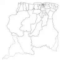
 Map showing the resorts of Coronie District. Johanna Maria | |
| Country | |
| District | Coronie District |
| Area | |
| • Total | 1,586 km2 (612 sq mi) |
| Population (2012)[1] | |
| • Total | 648 |
| • Density | 0.41/km2 (1.1/sq mi) |
| Time zone | UTC-3 (AST) |
Johanna Maria is a town and resort in Suriname, located in the Coronie District. Its population at the 2012 census was 648.[1] The town is named the cotton plantation Johanna Maria founded in 1801[2] which was owned by Johanna Maria Christina van Onna from 1863 onwards.[3] The coast line subject to flooding and erosion caused by the degradation of the mangrove forests. Plans have been drawn up to construct a 12 kilometre long dike near the coast.[4]
Johanna Maria has a school, and clinic, but the area from Clyde to Burnside has no electricity, or telephone.[4] In 1970 the Krioro Masanga was built in Johanna Maria, a multi purpose information and recreation building with a theatre and a library.[5]
References
- 1 2 "2012 Census Resorts Suriname" (PDF). Spang Staging. Retrieved 11 May 2020.
- ↑ "Coronie Webportal - Johanna Maria" (in Dutch). Retrieved 25 May 2020.
- ↑ "Plantage Johanna Maria". Suriname Plantages. Retrieved 25 May 2020.
- 1 2 "Structuur Analyse" (PDF). Planning Office Suriname (in Dutch). Retrieved 25 May 2020.
- ↑ "Een geschiedenis van de Surinaamse literatuur. Deel 4". Digital Library for Dutch Literature (in Dutch). 2002. Retrieved 25 May 2020.
External links
This article is issued from Wikipedia. The text is licensed under Creative Commons - Attribution - Sharealike. Additional terms may apply for the media files.
