Howell Mountain | |
|---|---|
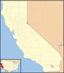
 Howell Mountain Location in California  Howell Mountain Howell Mountain (the United States) | |
| Coordinates: 38°34′53″N 122°27′04″W / 38.58139°N 122.45111°W | |
| Country | |
| State | |
| County | Napa County |
| Elevation | 1,683 ft (513 m) |
Howell Mountain (formerly, White Cottage)[2] is an unincorporated community in the Vaca Mountains, within Napa County, California.[1] It lies at an elevation of 1683 feet (513 m).[1]
History
Howell Mountain was originally territory of the Wappo people. It was settled by European-Americans beginning in the 1840s. Wine grapes were first planted on the mountain in the 1870s by William Campbell Watson, grandson-in-law of settler George Yount. Numerous wineries and health spas were built in the area in the late nineteenth and early twentieth centuries.[3]
In August 2020, Howell Mountain was evacuated due to the Hennessey Fire, which resulted in the burning of over 315,000 acres (127,476 ha) in five counties, including near Howell Mountain.[4]
Geography
Howell Mountain is located 5.5 miles (8.9 km) north-northeast of Saint Helena.[2]
For census purposes, it forms part of the Angwin census-designated place.[2]
References
- 1 2 3 U.S. Geological Survey Geographic Names Information System: Howell Mountain, California
- 1 2 3 Durham, David L. (1998). California's Geographic Names: A Gazetteer of Historic and Modern Names of the State. Clovis, Calif.: Word Dancer Press. p. 644. ISBN 1-884995-14-4.
- ↑ Van Arsdale, Katharine (2021). Angwin and Howell Mountain. Charleston, SC: Arcadia Publishing. pp. 27–30. ISBN 978-1-4671-0625-2.
- ↑ "Hennessey Fire Information". CAL FIRE. Retrieved August 17, 2020.
