Hanestad | |
|---|---|
Village | |
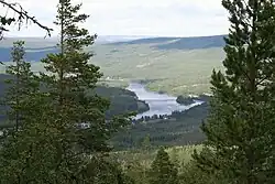
 View of the village | |
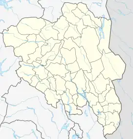
 Hanestad Location of the village  Hanestad Hanestad (Norway) | |
| Coordinates: 61°50′17″N 10°52′47″E / 61.83796°N 10.87985°E | |
| Country | Norway |
| Region | Eastern Norway |
| County | Innlandet |
| District | Østerdalen |
| Municipality | Rendalen Municipality |
| Elevation | 381 m (1,250 ft) |
| Time zone | UTC+01:00 (CET) |
| • Summer (DST) | UTC+02:00 (CEST) |
| Post Code | 2478 Hanestad |
Hanestad is a village in Rendalen Municipality in Innlandet county, Norway. The village is located along the river Glomma, about 15 kilometres (9.3 mi) southwest of the village of Bergset. The Norwegian National Road 3 runs through the village. The Rørosbanen railway line also runs through the village, stopping at Hanestad Station, the only railroad station in Rendalen. In 2021, the village had 40 residents.[2]
In Hanestad there is a gas station/service center, an inn, Hanestad Station, and Hanestad Church. About 6 kilometres (3.7 mi) north of Hanestad is the waterfall Tegningfallet. About 20 kilometres (12 mi) north of Hanestad is Jutulhogget, one of northern Europe's longest canyons.
References
- ↑ "Hanestad, Rendalen". yr.no. Retrieved 18 February 2022.
- ↑ "04317: Population, by basic statistical unit, contents and year". Statistics Norway. Retrieved 18 February 2022.
External links
This article is issued from Wikipedia. The text is licensed under Creative Commons - Attribution - Sharealike. Additional terms may apply for the media files.