| Guerrero Glacier | |
|---|---|
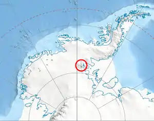 Location of Sentinel Range in Western Antarctica | |
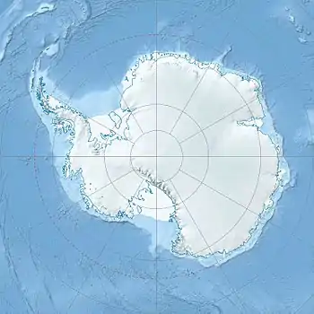 Location of Guerrero Glacier in Antarctica | |
| Location | Ellsworth Land |
| Coordinates | 78°32′00″S 84°15′00″W / 78.53333°S 84.25000°W |
| Length | 7 nautical miles (13 km; 8.1 mi) |
| Thickness | unknown |
| Terminus | Taylor Spur |
| Status | unknown |
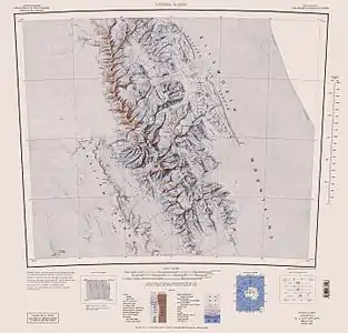
Central and southern Sentinel Range map.
Guerrero Glacier (78°32′S 84°15′W / 78.533°S 84.250°W) is a glacier about 7 nautical miles (13 km) long in Doyran Heights, draining from the southeast slopes of Mount Havener southwest of Beloslav Peak to the south side of Taylor Spur, in the southeast part of the Sentinel Range, Ellsworth Mountains, Antarctica. It was first mapped by the United States Geological Survey from surveys and U.S. Navy air photos, 1957–59, and was named by the Advisory Committee on Antarctic Names for John F. Guerrero, a meteorologist at South Pole Station in 1957.[1]
See also
Maps
- Vinson Massif. Scale 1:250 000 topographic map. Reston, Virginia: US Geological Survey, 1988.
- Antarctic Digital Database (ADD). Scale 1:250000 topographic map of Antarctica. Scientific Committee on Antarctic Research (SCAR). Since 1993, regularly updated.
References
 This article incorporates public domain material from "Guerrero Glacier". Geographic Names Information System. United States Geological Survey.
This article is issued from Wikipedia. The text is licensed under Creative Commons - Attribution - Sharealike. Additional terms may apply for the media files.