Fargues-Saint-Hilaire | |
|---|---|
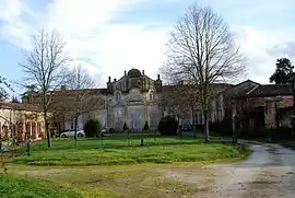 Chateau of Beauséjour | |
Location of Fargues-Saint-Hilaire | |
 Fargues-Saint-Hilaire 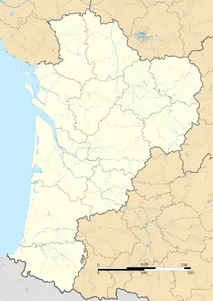 Fargues-Saint-Hilaire | |
| Coordinates: 44°49′27″N 0°26′39″W / 44.8242°N 0.4442°W | |
| Country | France |
| Region | Nouvelle-Aquitaine |
| Department | Gironde |
| Arrondissement | Bordeaux |
| Canton | Créon |
| Intercommunality | Coteaux Bordelais |
| Government | |
| • Mayor (2020–2026) | Bertrand Gautier[1] |
| Area 1 | 7.02 km2 (2.71 sq mi) |
| Population | 3,404 |
| • Density | 480/km2 (1,300/sq mi) |
| Time zone | UTC+01:00 (CET) |
| • Summer (DST) | UTC+02:00 (CEST) |
| INSEE/Postal code | 33165 /33370 |
| Elevation | 17–88 m (56–289 ft) |
| 1 French Land Register data, which excludes lakes, ponds, glaciers > 1 km2 (0.386 sq mi or 247 acres) and river estuaries. | |
Fargues-Saint-Hilaire (French pronunciation: [faʁɡ sɛ̃.t‿ilɛʁ]; Occitan: Fargas Sent Ilari) is a commune in the Gironde department in Nouvelle-Aquitaine in southwestern France.
Population
| Year | Pop. | ±% p.a. |
|---|---|---|
| 1968 | 1,104 | — |
| 1975 | 1,212 | +1.34% |
| 1982 | 1,583 | +3.89% |
| 1990 | 2,032 | +3.17% |
| 1999 | 2,249 | +1.13% |
| 2007 | 2,745 | +2.52% |
| 2012 | 2,715 | −0.22% |
| 2017 | 2,889 | +1.25% |
| Source: INSEE[3] | ||
See also
References
- ↑ "Répertoire national des élus: les maires" (in French). data.gouv.fr, Plateforme ouverte des données publiques françaises. 13 September 2022.
- ↑ "Populations légales 2021". The National Institute of Statistics and Economic Studies. 28 December 2023.
- ↑ Population en historique depuis 1968, INSEE
External links
Wikimedia Commons has media related to Fargues-Saint-Hilaire.
This article is issued from Wikipedia. The text is licensed under Creative Commons - Attribution - Sharealike. Additional terms may apply for the media files.