El Fuerte Airfield Aeródromo de El Fuerte | |||||||||||
|---|---|---|---|---|---|---|---|---|---|---|---|
 | |||||||||||
| Summary | |||||||||||
| Airport type | Public | ||||||||||
| Serves | El Fuerte, Sinaloa, Mexico | ||||||||||
| Time zone | MST (UTC−07:00) | ||||||||||
| Elevation AMSL | 97 m / 318 ft | ||||||||||
| Coordinates | 26°23′53″N 108°36′41″W / 26.39806°N 108.61139°W | ||||||||||
| Map | |||||||||||
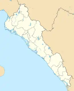
 MM79 Location of the airport in Sinaloa  MM79 MM79 (Mexico) | |||||||||||
| Runways | |||||||||||
| |||||||||||
| Statistics (2023) | |||||||||||
| |||||||||||
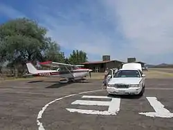
El Fuerte Airfield (Spanish: Aeródromo de El Fuerte) (ICAO: MM79) is a small airfield located in El Fuerte, Sinaloa, Mexico. It handles domestic air traffic and supports flight training and general aviation activities. The airfield does not provide scheduled passenger public services. The nearest airport that serves commercial flights is Los Mochis International Airport.
Situated at an elevation of 97 metres (318 ft) above mean sea level, it features a single asphalt runway, designated as 14/32, measuring 1,463 by 20 metres (4,800 by 66 ft). Adjacent facilities include an apron with parking positions for aircraft, and a small terminal building. It underwent renovations in 2019.[1]
See also
References
External links
This article is issued from Wikipedia. The text is licensed under Creative Commons - Attribution - Sharealike. Additional terms may apply for the media files.