Courbesseaux | |
|---|---|
_mairie.jpg.webp) The town hall in Courbesseaux | |
 Coat of arms | |
Location of Courbesseaux | |
 Courbesseaux 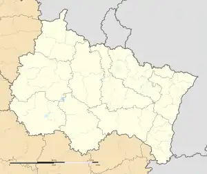 Courbesseaux | |
| Coordinates: 48°41′25″N 6°23′48″E / 48.6903°N 6.3967°E | |
| Country | France |
| Region | Grand Est |
| Department | Meurthe-et-Moselle |
| Arrondissement | Lunéville |
| Canton | Lunéville-1 |
| Intercommunality | CC Pays du Sânon |
| Government | |
| • Mayor (2020–2026) | Fabrice Boyer[1] |
| Area 1 | 6.32 km2 (2.44 sq mi) |
| Population | 381 |
| • Density | 60/km2 (160/sq mi) |
| Time zone | UTC+01:00 (CET) |
| • Summer (DST) | UTC+02:00 (CEST) |
| INSEE/Postal code | 54139 /54110 |
| Elevation | 217–293 m (712–961 ft) (avg. 230 m or 750 ft) |
| 1 French Land Register data, which excludes lakes, ponds, glaciers > 1 km2 (0.386 sq mi or 247 acres) and river estuaries. | |
Courbesseaux (French pronunciation: [kuʁbɛso]) is a commune in the Meurthe-et-Moselle department in north-eastern France. It has a small population, it also contains a medium-sized military cemetery from WW2, at the middle of the town is also located the église de la Sainte-Croix de Courbesseaux, an old church, now rarely used, except for the bus stop next to it used by children.
See also
References
- ↑ "Répertoire national des élus: les maires". data.gouv.fr, Plateforme ouverte des données publiques françaises (in French). 9 August 2021.
- ↑ "Populations légales 2021". The National Institute of Statistics and Economic Studies. 28 December 2023.
Wikimedia Commons has media related to Courbesseaux.
This article is issued from Wikipedia. The text is licensed under Creative Commons - Attribution - Sharealike. Additional terms may apply for the media files.