Colômbia | |
|---|---|
 Flag  Coat of arms | |
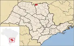
 Location in São Paulo state | |
 Colômbia Location in Brazil | |
| Coordinates: 20°10′33″S 48°41′20″W / 20.17583°S 48.68889°W | |
| Country | Brazil |
| Region | Southeast |
| State | São Paulo |
| Microregion | Barretos |
| Government | |
| • Mayor | Endrigo Lucas Gambarato Bertin (PTB) |
| Area | |
| • Total | 728.65 km2 (281.33 sq mi) |
| Population (2020 [1]) | |
| • Total | 6,216 |
| • Density | 8.5/km2 (22/sq mi) |
| Time zone | UTC−3 (BRT) |
| Website | www |
Colômbia is a municipality in the northern part of the state of São Paulo in Brazil. The population is 6,216 (2020 est.) in an area of 728.65 km².[2] The elevation is 492 m. The bounding municipalities are Barretos to the south and Guaíra to the east. To the north, on the other side of the Rio Grande, is the state of Minas Gerais and the municipality of Planura.
References
External links
- (in Portuguese) http://www.colombia.sp.gov.br
- (in Portuguese) citybrazil.com.br
This article is issued from Wikipedia. The text is licensed under Creative Commons - Attribution - Sharealike. Additional terms may apply for the media files.