Boľkovce | |
|---|---|
Municipality | |
_-_R%C3%ADmsko-katol%C3%ADcky_kostol.jpg.webp) Roman Catholic church in Boľkovce (local part Osada) | |
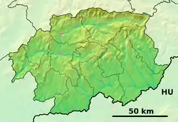
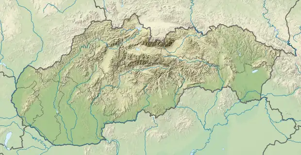
 Boľkovce Location of Boľkovce in the Banská Bystrica Region  Boľkovce Location of Boľkovce in Slovakia | |
| Coordinates: 48°20′N 19°47′E / 48.333°N 19.783°E | |
| Country | |
| Region | Banská Bystrica |
| District | Lučenec |
| First mentioned | 1255 |
| Area | |
| • Total | 10.99 km2 (4.24 sq mi) |
| Elevation | 186 m (610 ft) |
| Time zone | UTC+1 (CET) |
| • Summer (DST) | UTC+2 (CEST) |
| Postal code | 984 01 (pošta Lučenec 1) |
| Area code | +421-47 |
| Car plate | LC |
| Website | www.bolkovce.sk |
Boľkovce (before 1948: Bolyk; Hungarian: Bolyk or Ipolybolyk) is a village and municipality in the Lučenec District in the Banská Bystrica Region of Slovakia.
History
In historical records, the village was first mentioned in 1320 and 1435 as Bolk (1467 Bwlyk, 1481 Bolyk). In 1481, it belonged to Divín Castle lords and later on to the Somoskő lords. In the mid-16th century it was occupied and destroyed by the Ottoman Turks, from 1938 to 1945 by Hungary.
Climate
| Climate data for Boľkovce (1991−2020) | |||||||||||||
|---|---|---|---|---|---|---|---|---|---|---|---|---|---|
| Month | Jan | Feb | Mar | Apr | May | Jun | Jul | Aug | Sep | Oct | Nov | Dec | Year |
| Record high °C (°F) | 15.4 (59.7) |
19.3 (66.7) |
24.4 (75.9) |
30.4 (86.7) |
32.2 (90.0) |
35.8 (96.4) |
39.2 (102.6) |
37.5 (99.5) |
34.7 (94.5) |
27.6 (81.7) |
21.7 (71.1) |
14.2 (57.6) |
39.2 (102.6) |
| Mean daily maximum °C (°F) | 1.6 (34.9) |
5.0 (41.0) |
10.8 (51.4) |
17.6 (63.7) |
22.5 (72.5) |
25.7 (78.3) |
27.7 (81.9) |
27.7 (81.9) |
22.0 (71.6) |
15.5 (59.9) |
8.5 (47.3) |
2.0 (35.6) |
15.6 (60.1) |
| Daily mean °C (°F) | −1.8 (28.8) |
0.2 (32.4) |
4.9 (40.8) |
10.9 (51.6) |
15.6 (60.1) |
19.2 (66.6) |
20.8 (69.4) |
20.3 (68.5) |
15.1 (59.2) |
9.6 (49.3) |
4.5 (40.1) |
−0.9 (30.4) |
9.9 (49.8) |
| Mean daily minimum °C (°F) | −5.2 (22.6) |
−4.0 (24.8) |
−0.4 (31.3) |
4.0 (39.2) |
9.0 (48.2) |
12.4 (54.3) |
14.0 (57.2) |
13.7 (56.7) |
9.5 (49.1) |
5.0 (41.0) |
1.2 (34.2) |
−3.8 (25.2) |
4.6 (40.3) |
| Record low °C (°F) | −25.4 (−13.7) |
−22.0 (−7.6) |
−16.2 (2.8) |
−10.6 (12.9) |
−2.5 (27.5) |
2.8 (37.0) |
5.5 (41.9) |
3.0 (37.4) |
−1.2 (29.8) |
−10.0 (14.0) |
−13.3 (8.1) |
−26.1 (−15.0) |
−26.1 (−15.0) |
| Average precipitation mm (inches) | 30.7 (1.21) |
31.6 (1.24) |
30.3 (1.19) |
39.6 (1.56) |
69.8 (2.75) |
76.6 (3.02) |
88.6 (3.49) |
66.1 (2.60) |
47.8 (1.88) |
47.9 (1.89) |
47.0 (1.85) |
37.2 (1.46) |
612.9 (24.13) |
| Average precipitation days (≥ 1.0 mm) | 5.7 | 5.8 | 5.8 | 6.3 | 9.5 | 8.8 | 8.3 | 7.1 | 6.4 | 6.7 | 7.5 | 6.6 | 84.4 |
| Average snowy days | 8.7 | 7.0 | 3.5 | 0.4 | 0.0 | 0.0 | 0.0 | 0.0 | 0.0 | 0.1 | 2.6 | 6.1 | 28.5 |
| Average relative humidity (%) | 84.8 | 79.3 | 69.7 | 63.7 | 68.0 | 68.0 | 67.1 | 69.2 | 73.5 | 80.8 | 85.2 | 87.2 | 74.7 |
| Mean monthly sunshine hours | 63.5 | 95.2 | 156.8 | 207.4 | 244.1 | 258.2 | 273.4 | 264.3 | 183.6 | 129.9 | 68.3 | 49.9 | 1,994.6 |
| Source: NOAA[1] | |||||||||||||
Genealogical resources
The records for genealogical research are available at the state archive "Statny Archiv in Banska Bystrica, Slovakia"
- Roman Catholic church records (births/marriages/deaths): 1802-1895 (parish A)
- Lutheran church records (births/marriages/deaths): 1783-1895 (parish B)
See also
References
- ↑ "Bolkovce Climate Normals 1991–2020". World Meteorological Organization Climatological Standard Normals (1991–2020). National Oceanic and Atmospheric Administration. Archived from the original on 14 August 2023. Retrieved 14 August 2023.
External links
 Media related to Boľkovce at Wikimedia Commons
- Official website

- https://web.archive.org/web/20070513023228/http://www.statistics.sk/mosmis/eng/run.html
- Surnames of living people in Bolkovce
This article is issued from Wikipedia. The text is licensed under Creative Commons - Attribution - Sharealike. Additional terms may apply for the media files.