| Beinn Fhionnlaidh | |
|---|---|
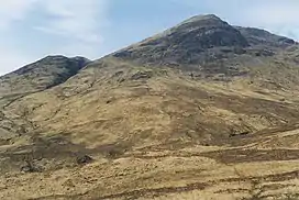 Beinn Fhionnlaidh from the east | |
| Highest point | |
| Elevation | 959 m (3,146 ft) |
| Prominence | 510 m (1,670 ft)[1] |
| Listing | Munro, Marilyn |
| Coordinates | 56°36′03″N 5°06′15″W / 56.600842°N 5.104069°W |
| Naming | |
| English translation | Finlay's mountain |
| Language of name | Gaelic |
| Geography | |
| Parent range | Grampian Mountains |
| OS grid | NN095497 |
| Topo map | OS Landranger 50, OS Explorer 384 |
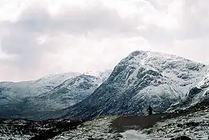
Beinn Fhionnlaidh is a mountain in the West Highlands of Scotland. It is situated between Glen Etive and Glen Creran, to the south of Glen Coe.
References
Wikimedia Commons has media related to Beinn Fhionnlaidh, Argyll and Bute.
- ↑ Database of British and Irish Hills. Retrieved 07 Jan 2013
 |
|  | |
This article is issued from Wikipedia. The text is licensed under Creative Commons - Attribution - Sharealike. Additional terms may apply for the media files.