| Baula | |
|---|---|
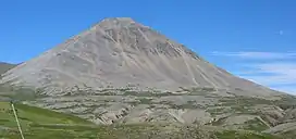 Baula, July 2006 | |
| Highest point | |
| Elevation | 934 m (3,064 ft) |
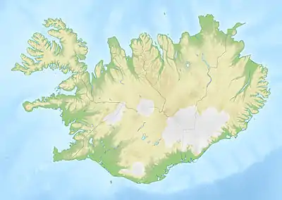
| Coordinates | 64°53′N 21°24′W / 64.883°N 21.400°W |
| Geography | |
 Baula | |
| Geology | |
| Age of rock | 3.4 million years |
| Mountain type | Laccolith |
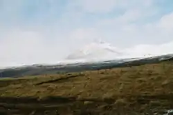
Baula (Icelandic pronunciation: [ˈpœyːla] ⓘ) is a mountain situated in the west of Iceland near Route 1, Bifröst University, and the craters of Grábrók. The mountain's reddish or orange hue is caused by its rhyolite rock composition.
The mountain Baula
Geologically, the mountain is a laccolith,[1] a type of igneous intrusion. It was formed 3.4 million years ago.[2]
Baula is characterized by its almost perfect cone. Nearby is Baula's “little sister,” a mountain called Litla-Baula, where rare columns of rhyolite are found. Together, Baula and Litla-Baula have often been described as Iceland's most beautiful pair of mountains.
See also
References
- ↑ Gudmundsson A., Pasquarè F.A., Tibaldi A. (2014) Dykes, Sills, Laccoliths, and Inclined Sheets in Iceland in Advances in Volcanology, Berlin, Springer, Figure 5b.
- ↑ Johannesson, Haukur (1975) Structure and petrochemistry of the Reykjadalur central volcano and the surrounding areas, Midwest Iceland, Doctoral thesis, Durham University.
- Hróarsson, Björn (1994) Á ferð um landið, Borgarfjörður og Mýrar, Mál og menning ISBN 9979-3-0657-2 (in Icelandic)
This article is issued from Wikipedia. The text is licensed under Creative Commons - Attribution - Sharealike. Additional terms may apply for the media files.