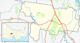
| Baringhup West Victoria | |
|---|---|
 Baringhup West | |
| Coordinates | 36°57′47″S 143°55′10″E / 36.96306°S 143.91944°E |
| Population | 16 (2016 census)[1] |
| Postcode(s) | 3463 |
| Elevation | 182[2] m (597 ft) |
| LGA(s) | Shire of Mount Alexander |
| State electorate(s) | Bendigo West |
| Federal division(s) | Bendigo[3] |
Baringhup West is a locality in the Mount Alexander Shire, Central Highlands and Goldfields, Victoria, Australia.[2]
References
- ↑ Australian Bureau of Statistics (27 June 2017). "Baringhup West (State Suburb)". 2016 Census QuickStats. Retrieved 24 May 2022.
- 1 2 "Baringhup West, Mount Alexander, Central Highlands and Goldfields, Australia on the Elevation Map". Retrieved 24 May 2022.
- ↑ "Localities Find my electorate: Baringhup West". Australian Electoral Commission. Retrieved 24 May 2022.
This article is issued from Wikipedia. The text is licensed under Creative Commons - Attribution - Sharealike. Additional terms may apply for the media files.