Aboite Township | |
|---|---|
 | |
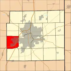 Location in Allen County, Indiana | |
| Coordinates: 41°03′08″N 85°17′07″W / 41.05222°N 85.28528°W | |
| Country | |
| State | |
| County | Allen |
| Government | |
| • Type | Indiana township |
| Area | |
| • Total | 33.35 sq mi (86.4 km2) |
| • Land | 33.33 sq mi (86.3 km2) |
| • Water | 0.03 sq mi (0.08 km2) 0.09% |
| Elevation | 850 ft (259 m) |
| Population (2010) | |
| • Total | 35,765 |
| • Density | 1,073.2/sq mi (414.4/km2) |
| Time zone | UTC-5 (Eastern (EST)) |
| • Summer (DST) | UTC-4 (EDT) |
| ZIP codes | 46783, 46804, 46809, 46814, 46818 |
| Area code | 260 |
| GNIS feature ID | 453072 |
| Website | www |
Aboite Township is one of twenty townships in Allen County, Indiana, United States. As of the 2010 census, its population was 35,765,[6] up from 28,338 in 2000.[7]
History
Aboite Township was named from the Aboite Creek, which is derived from the French word for "minnow".[8]
Geography
According to the 2010 census, the township has a total area of 33.35 square miles (86.4 km2), of which 33.33 square miles (86.3 km2) (or 99.94%) is land and 0.03 square miles (0.078 km2) (or 0.09%) is water.[6]
Cities and towns
- Fort Wayne (western portion)
Fort Wayne incorporated approximately 12 square miles (31 km2) of Aboite territory effective January 1, 2006.[9]
Unincorporated towns
Fort Wayne neighborhoods
- Brierwood Hills at 41°03′19″N 85°14′03″W / 41.055326°N 85.234139°W
- Covington Dells at 41°04′10″N 85°13′59″W / 41.069492°N 85.233028°W
- Forest Ridge at 41°01′19″N 85°16′24″W / 41.021992°N 85.273306°W
- Liberty Hills at 41°02′00″N 85°15′59″W / 41.033381°N 85.266362°W
- Manor Woods at 41°01′31″N 85°15′44″W / 41.025326°N 85.262195°W
- Parkway Hills at 41°01′42″N 85°15′52″W / 41.028381°N 85.264417°W
- Rolling Hills at 41°01′38″N 85°16′05″W / 41.02727°N 85.268029°W
- Westlakes at 41°02′31″N 85°15′57″W / 41.0420450°N 85.2659413°W
- Westlawn at 41°04′49″N 85°13′39″W / 41.080326°N 85.227473°W
Adjacent townships
- Lake Township (north)
- Washington Township (northeast)
- Wayne Township (east)
- Lafayette Township (south)
- Jackson Township, Huntington County (southwest)
- Jefferson Township, Whitley County (west)
- Union Township, Whitley County (northwest)
Major highways
Cemeteries
The township contains these two cemeteries: Covington Memorial Gardens and Oak Grove.
Airports and landing strips
- Dennis Airport
School districts
Political districts
- Indiana's 3rd congressional district
- State House District 82
- State House District 83
- State Senate District 16
References
Citations
- "National Register of Historic Places Listings". Archived from the original on November 18, 2015. Retrieved June 11, 2014.
- "Google Maps".
- ↑ "National Register of Historic Places Listings". Archived from the original on November 18, 2015. Retrieved June 11, 2014.
- ↑ "Google Maps".
- ↑ "US Board on Geographic Names". United States Geological Survey. October 25, 2007. Retrieved January 31, 2008.
- 1 2 "Geographic Identifiers: 2010 Demographic Profile Data (DP-1): Aboite township, Allen County, Indiana". U.S. Census Bureau, American Factfinder. Archived from the original on February 12, 2020. Retrieved March 25, 2013.
- ↑ United States Census Bureau U.S. Census website
- ↑ Griswold, Bert Joseph; Taylor, Mrs. Samuel R. (1917). The Pictorial History of Fort Wayne, Indiana: A Review of Two Centuries of Occupation of the Region about the Head of the Maumee River. Robert O. Law Company. p. 687.
- ↑ "City of Fort Wayne - Southwest Extended Annexation".
Sources
External links
Wikimedia Commons has media related to Aboite Township, Allen County, Indiana.
Places adjacent to Aboite Township, Allen County, Indiana | |
|---|---|
Municipalities and communities of Allen County, Indiana, United States | ||
|---|---|---|
| Cities | Map of Indiana highlighting Allen County | |
| Towns | ||
| Townships | ||
| CDPs | ||
| Other communities | ||
| Footnotes | ‡This populated place also has portions in an adjacent county or counties | |
This article is issued from Wikipedia. The text is licensed under Creative Commons - Attribution - Sharealike. Additional terms may apply for the media files.