  | |
| UTC time | 1981-01-19 15:11:01 |
|---|---|
| ISC event | 632891 |
| USGS-ANSS | ComCat |
| Local date | January 20, 1981 |
| Local time | 00:11:01 WIT |
| Magnitude | 6.7 Mw |
| Depth | 33.0 km (20.5 mi) |
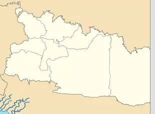
| Epicenter | 4°35′S 139°14′E / 4.58°S 139.23°E |
| Areas affected | Irian Jaya (now Highland Papua), Indonesia |
| Max. intensity | VII (Very strong) |
| Casualties | 305 dead, 1,000+ missing |
Shortly after midnight local time on January 20 (January 19, UTC), 1981, eastern Indonesia was struck by an earthquake known as the 1981 Irian Jaya earthquake. Registering a moment magnitude of 6.7, it killed more than 300 people, damaging structures and buildings across the Irian Jaya province. Indonesia is highly active in terms of seismicity and volcanic eruptions, with a subduction zone and many faults. It is neighbored by several tectonic plates. Such earthquakes pose a significant threat to life in the area through earthquakes and also tsunamis.
Geology
Indonesia, one of the most seismically active places in the world, hosts hundreds of islands, many with volcanoes. It is an island arc, composed by a subduction zone (in the Sunda Trench) and islands. Unlike most subduction zones, the Sunda Trench is parallel to the chain of islands to which it corresponds, creating strike-slip faulting. Indonesia itself is surrounded by multiple tectonic plates – namely the Pacific, the Southeast Asia lithospheric, and the Indo-Australian Plates – causing it to be a so-called hotspot for both seismic and volcanic activity.[1] The epicenter was in Papua Province, in the Irian Jaya Province. The orientation and type of faulting is uncertain, due to a poorly constrained focal mechanism but is thought to have been a reverse fault.[2]
Damage and casualties
Spawning enormous landslides, the earthquake left at least 305 people dead and more than 1,000 missing. Entire villages were covered by debris.[3] It was described as "strong" by The New York Times.[4] The earthquake caused huge landslides, which cascaded into the villages below the mountains, destroying more than 150 homes. The debris from these flows blocked transportation by road, "cutting off more than 2,000 area residents".[5] Relief efforts took several days.[6]
Future threats
Indonesia is known for deadly earthquakes, primarily the 2004 Indian Ocean earthquake and tsunami, which killed more than 227,000 people. Earthquakes along the subduction zone at Sunda and on the Great Sumatran fault pose a serious threat to life, especially in the form of tsunamis. A 2005 study found that stress on at least these two zones was at a heightened level,[7] and both have been active. The Sunda Trench zone has since produced the 2006 Pangandaran earthquake and tsunami, while the Great Sumatran fault has not produced an earthquake since the 2004 event.
See also
References
- ↑ "Seismotectonics of the Indonesian Region". United States Geological Survey. 26 October 2009. Retrieved 18 January 2010.
- ↑ "Significant Earthquakes of the World - 1981". United States Geological Survey. 5 January 2010. Archived from the original on 11 October 2012. Retrieved 17 January 2010.
- ↑ "Today in Earthquake History - January 19". United States Geological Survey. 27 October 2009. Retrieved 16 January 2010.
- ↑ "Strong Quake Strikes Indonesia". The New York Times. 20 January 1981. Retrieved 17 January 2010.
- ↑ "Earthquake rocks Indonesia". The Register-Guard. Alton F. "Tony" Baker III. 21 January 1981. Retrieved 16 January 2010.
- ↑ "Indonesia quake kills 67". Milwaukee Journal Sentinel. Elizabeth Brenner. 24 January 1981. Archived from the original on 2012-07-13. Retrieved 17 January 2010.
- ↑ McCloskey, John; Nalbant, Suleyman S. & Steacy, Sandy (March 2005). "Indonesian earthquake: Earthquake risk from co-seismic stress". Nature. 434 (7031): 291. Bibcode:2005Natur.434..291M. doi:10.1038/434291a. PMID 15772639.
External links
- The International Seismological Centre has a bibliography and/or authoritative data for this event.