Šestajovice | |
|---|---|
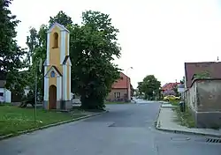 Belfry | |
.svg.png.webp) Flag  Coat of arms | |
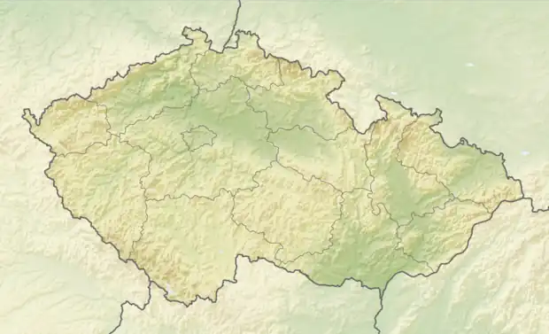 Šestajovice Location in the Czech Republic | |
| Coordinates: 50°6′27″N 14°40′53″E / 50.10750°N 14.68139°E | |
| Country | |
| Region | Central Bohemian |
| District | Prague-East |
| First mentioned | 1227 |
| Government | |
| • Mayor | Roman Hrdlic |
| Area | |
| • Total | 5.42 km2 (2.09 sq mi) |
| Elevation | 254 m (833 ft) |
| Population (2023-01-01)[1] | |
| • Total | 4,021 |
| • Density | 740/km2 (1,900/sq mi) |
| Time zone | UTC+1 (CET) |
| • Summer (DST) | UTC+2 (CEST) |
| Postal code | 250 92 |
| Website | www |
Šestajovice is a municipality and village in Prague-East District in the Central Bohemian Region of the Czech Republic. It has about 4,000 inhabitants.
Geography
Šestajovice is located east of Prague, in its immediate vicinity. It is urbanistically fused with Prague-Klánovice. It lies in a flat landscape of the Central Elbe Table.
History
The first written mention of Šestajovice is from 1227. From 1227 until the Hussite Wars, the village was property of the Knights of the Cross with the Red Star from the Zderaz Monastery in Prague, then the owners often changed.[2]
Demographics
|
|
| ||||||||||||||||||||||||||||||||||||||||||||||||||||||
| Source: Censuses[3][4] | ||||||||||||||||||||||||||||||||||||||||||||||||||||||||
Transport
The D11 motorway from Prague to Hradec Králové passes through the municipality.
Sights
Šestajovice is poor in monuments. The only cultural monument is a sandstone cross, which dates from 1779.[5] There is also a belfry.
References
- ↑ "Population of Municipalities – 1 January 2023". Czech Statistical Office. 2023-05-23.
- ↑ "Historie" (in Czech). Obec Šestajovice. Retrieved 2023-04-03.
- ↑ "Historický lexikon obcí České republiky 1869–2011 – Okres Praha-východ" (in Czech). Czech Statistical Office. 2015-12-21. pp. 11–12.
- ↑ "Population Census 2021: Population by sex". Public Database. Czech Statistical Office. 2021-03-27.
- ↑ "Výsledky vyhledávání: Kulturní památky, obec Šestajovice". Ústřední seznam kulturních památek (in Czech). National Heritage Institute. Retrieved 2023-04-03.