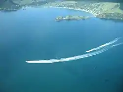
Ōakura | |
|---|---|
 Ōakura Bay | |
| Coordinates: 35°23′36″S 174°20′40″E / 35.393333°S 174.344463°E | |
| Country | New Zealand |
| Region | Northland Region |
| District | Whangarei District |
| Ward | Hikurangi-Coastal Ward |
| Government | |
| • Territorial Authority | Whangarei District Council |
| • Regional council | Northland Regional Council |
Ōakura is a small coastal settlement in the Whangarei District and Northland Region of New Zealand's North Island.[1]
The local Mōkau Marae and Huruiki meeting house is a meeting place of the Ngātiwai hapū of Te Uri o Hikihiki.[2][3] The hapū also has another marae, Ōākura Marae, under construction.[2]
Demographics
Ōakura is part of the Ōakura-Whangaruru South settlement.[4]
References
- ↑ Hariss, Gavin. "Oakura, Northland". topomap.co.nz. NZ Topo Map.
- 1 2 "Te Kāhui Māngai directory". tkm.govt.nz. Te Puni Kōkiri.
- ↑ "Māori Maps". maorimaps.com. Te Potiki National Trust.
- ↑ "ArcGIS Web Application". statsnz.maps.arcgis.com. Retrieved 16 April 2022.
This article is issued from Wikipedia. The text is licensed under Creative Commons - Attribution - Sharealike. Additional terms may apply for the media files.