 Æðey | |
| Geography | |
|---|---|
| Location | Ísafjarðardjúp |
| Coordinates | 66°06′01″N 22°39′42″W / 66.1004°N 22.6617°W |
| Area | 1.76 km2 (0.68 sq mi) |
| Administration | |
| Constituency | Northwest |
| Region | Vestfirðir |
| Demographics | |
| Languages | Icelandic |
| Ethnic groups | Icelanders |
| Additional information | |
| Time zone | |
Æðey (Icelandic pronunciation: [ˈaiːðˌeiː] ⓘ) (a.k.a. "Aedey Island") is a small island in the Westfjords region of Iceland.[1] It measures approximately 2 by 0.5 kilometres (1+1⁄4 mi × 1⁄4 mi), and the highest point is at an elevation of about 18 m (59 ft).
It is inhabited by a single family and is a private family farm focused on environmentally sound eider down farming.[2]
The lighthouse[2] was built in 1944, (operating since 1949) near the southernmost point of the island.
Æðey is important in the history of Iceland and especially of the Westfjords region.
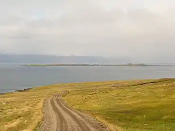
Æðey in Ísafjarðardjúp
References
- ↑ "Aedey Island". NAT Nordic Adventure Travel. Retrieved 20 June 2021.
- 1 2 Posnett, Edward (19 July 2019). "The weird magic of eiderdown". The Guardian. Retrieved 11 July 2023.
This article is issued from Wikipedia. The text is licensed under Creative Commons - Attribution - Sharealike. Additional terms may apply for the media files.