Joshua Tree

census designated place in San Bernardino County, California, United States


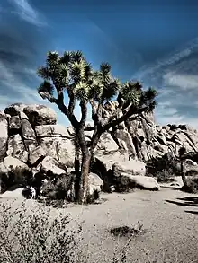
Joshua Tree is a village in south central San Bernadino County in the California Desert, on the northern boundary of the Joshua Tree National Park.

Not to be confused with Joshua Tree National Park, a national park bordering the town to the south.

Understand

Joshua Tree is a village in the Morongo Basin, on California State Route 62 between Yucca Valley to the west and Twentynine Palms to the east.

Joshua Tree is home to Joshua Tree National Park, with the western entrance to the park located to the south.

Aside from the park, Joshua Tree (also known simply as "JT") is an artists and musicians community, with a farmers market and art galleries.

Get in

By car

Most visitors will arrive by car on  California State Route 62, which runs east-west through the Morongo Basin, west from the Palm Springs area and Yucca Valley, and east from Twentynine Palms and the Arizona state line.

By bus

There is a limited bus network, run by the Morongo Basin Transit Authority (MBTA). There's an hourly service to Twentynine Palms and to Yucca Valley, where it is possible to connect with Palm Springs.

By plane

The closest passenger airport is:

Further afield are:

Get around

See

Do

Joshua Tree National Park Visitor Center, located in Joshua Tree Village

Buy

Eat

Drink

Sleep

Go next

  • Joshua Tree National Park, south β€” The large national park south of the town is home to two desert ecosystems and is a favorite for campers, hikers, and rock-climbers.
Routes through Joshua Tree
Palm Springs ← Yucca Valley ←  W  E  β†’ Twentynine Palms β†’ Jct N S β†’ becomes β†’ Jct N S


This article is issued from Wikivoyage. The text is licensed under Creative Commons - Attribution - Sharealike. Additional terms may apply for the media files.