Hokianga
river in Northland Region, New Zealand
The Hokianga area surrounds the Hokianga Harbour in the Northland region of the North Island of New Zealand. It is sparsely populated and has many little clusters of houses in a very rural setting. The density of population is less than one per square kilometre. A good place to relax and chill out.
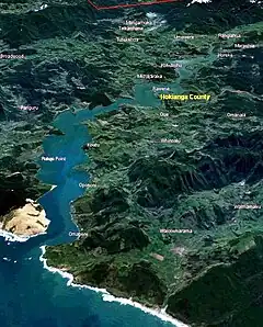
Oblique 3-D view of Hokianga Harbour and surrounding area
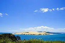
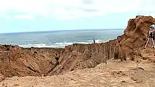
North Head sand dune, viewed across the harbour
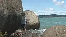
Have a play with big balls, the Koutu Boulders
The icon for the Hokianga is the kauri tree, with 75% of all kauri trees being in the Hokianga. It has four protected kauri forests: Waipoua in the south-west, Omahuta to the north-east, Warawara in the north-west and Puketi in the east.

This article is issued from Wikivoyage. The text is licensed under Creative Commons - Attribution - Sharealike. Additional terms may apply for the media files.