U.S. Highway 15 | ||||
|---|---|---|---|---|
US 15 highlighted in red | ||||
| Route information | ||||
| Maintained by NCDOT | ||||
| Length | 159 mi[1] (256 km) | |||
| Existed | 1927–present | |||
| Major junctions | ||||
| South end | ||||
| North end | ||||
| Location | ||||
| Country | United States | |||
| State | North Carolina | |||
| Counties | Scotland, Hoke, Moore, Lee, Chatham, Orange, Durham, Granville | |||
| Highway system | ||||
| ||||

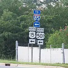
U.S. Highway 15 (US 15) is a north–south United States Numbered Highway running from Walterboro, South Carolina, to Painted Post, New York. In the U.S. state of North Carolina, the highway runs for 159 miles (256 km) from the South Carolina state line to the south of Laurinburg to the Virginia state line north of Bullock. US 15 travels in concurrency with US 501 for 106 miles (171 km) between Laurinburg and Durham.[2]
Route description
From the South Carolina state line, US 15 is in concurrency with US 401 to Laurinburg. Merging with US 501, it becomes what is known as "15-501" ("Fifteen Five-o-one"), a concurrency that extends for 106 miles (171 km) across central North Carolina; US 15 also the dominant partner, using its milemarkers along the route. After Laurinburg, it goes north to Aberdeen, linking briefly with US 1 before continuing to Pinehurst. In Pinehurst, US 15/US 501 goes through a rare roundabout, then continues north, through Carthage, back to US 1. After another brief concurrency with US 1 through Sanford, it exits off the freeway and goes due north to Pittsboro. After Pittsboro, US 15/US 501 becomes an expressway, connecting the cities of Chapel Hill and Durham; this section of the route is famous because of the two universities it connects: University of North Carolina at Chapel Hill and Duke University. Though the road is a symbol of the separation of the Carolina–Duke rivalry, the North Carolina Department of Transportation has been trying to remedy that by making the route a superstreet for better traffic flow.[3] In Durham, US 15/US 501 upgrades to an urban freeway, allowing for quick access from south Durham to north; the freeway ends merging into Interstate 85 (I-85). At exit 176B (on I-85), US 501 splits off toward Roxboro, while US 15 continues with I-85 toward Oxford.
After Durham, US 15 continues to follow I-85 till exit 186A, where it goes first to Creedmoor, then on into Oxford. After going through downtown Oxford, it continues north, near Mayo Lake, to Clarksville, Virginia.
History
Established in 1927, it was aligned along North Carolina Highway 75 from the South Carolina state line, through Rockingham, Pinehurst, and Durham, to the Virginia state line.[4]
Junction list
| County | Location | mi[1] | km | Exit | Destinations | Notes |
|---|---|---|---|---|---|---|
| Scotland | | 0.00 | 0.00 | Continuation into South Carolina | ||
| Laurinburg | 5.0 | 8.0 | ||||
| 6.0 | 9.7 | Southern end of US 501 concurrency; I-74 exit 183 | ||||
| 7.0 | 11.3 | |||||
| 9.0 | 14.5 | Northern end of US 401 concurrency | ||||
| | 12.0 | 19.3 | ||||
| Drowning Creek | Scotland-Hoke county line | |||||
| Moore | Aberdeen | 31.8 | 51.2 | Southern end of NC 211 concurrency | ||
| 32.0 | 51.5 | Southern end of US 1 concurrency | ||||
| 32.2 | 51.8 | |||||
| 34.0 | 54.7 | Northern end of US 1 concurrency | ||||
| Pinehurst | 38.0 | 61.2 | Roundabout; northern end of NC 211 concurrency | |||
| | 41.5 | 66.8 | ||||
| Carthage | 45.0 | 72.4 | Southern end of NC 22 concurrency | |||
| 46.0 | 74.0 | Northern end of NC 22 concurrency | ||||
| 48.0 | 77.2 | Southern end of NC 24 / NC 27 concurrency | ||||
| | 50.0 | 80.5 | Northern end of NC 24 / NC 27 concurrency | |||
| Lee | | 59.0 | 95.0 | Southern end of US 1 concurrency | ||
| Tramway | 61.0 | 98.2 | ||||
| Sanford | 63.5 | 102.2 | 66 | South end of freeway; exit numbers follow US 1 | ||
| 65.0 | 104.6 | 68 | Spring Lane | |||
| 65.5 | 105.4 | 69A | Southern end of NC 87 concurrency | |||
| 66.0 | 106.2 | 69B | Burns Drive / Canterbury Road | |||
| 66.5 | 107.0 | 70 | ||||
| 67.5 | 108.6 | Roundabout interchange; north end of freeway section; northern end of US 1 concurrency; US 1 exit 71 | ||||
| Deep River | Bridge | |||||
| Chatham | Pittsboro | 81.0 | 130.4 | Northern end of NC 87 concurrency | ||
| 82.0 | 132.0 | |||||
| 84.0 | 135.2 | US 64 exit 383 | ||||
| Orange | Chapel Hill | 97.0 | 156.1 | Interchange; southern end of NC 54 concurrency | ||
| 99.0 | 159.3 | Cloverleaf interchange; northern end of NC 54 concurrency | ||||
| 102.0 | 164.2 | Franklin Street | Interchange; southbound exit and northbound entrance | |||
| Durham | Durham | 103.0 | 165.8 | I-40 exit 270 | ||
| 105.0 | 169.0 | 105A-B | South end of freeway; signed as exit 105A (US 15 Bus./US 501 Bus.) and 105B (MLK Pkwy.) | |||
| 106.0 | 170.6 | 106 | Cornwallis Road | |||
| 107.0 | 172.2 | 107 | ||||
| 108.0– 108.5 | 173.8– 174.6 | 108A | Morreene Road | Southbound exit and northbound entrance ramps use C/D lanes | ||
| 108B-C | Access via C/D lanes; signed as exits 108B (south) and 108C (north) | |||||
| 108D | Northbound exit and southbound entrance ramps use C/D lanes | |||||
| 109.0 | 175.4 | — | Southern end of I-85 / US 70 concurrency; I-85 exit 174A; southbound left exit and northbound left entrance | |||
| 174B | Hillandale Road | Exit numbers follow I-85 | ||||
| 175 | To NC School of Science & Math and Duke Homestead | |||||
| 111.5 | 179.4 | 176 | North end of US 501 overlap; signed northbound as exits 176A (Gregson St.) and 176B (US 501) | |||
| 177 | To North Carolina Central University | |||||
| 112.5 | 181.1 | 178 | Northern end of US 70 concurrency; US 70 exit 285 | |||
| 179 | East Club Boulevard | |||||
| 180 | Glenn School Road | |||||
| Gorman | 182 | Red Mill Road | ||||
| 183 | Redwood Road | |||||
| Falls Lake | Bridge | |||||
| Granville | | 122.0 | 196.3 | Northern end of I-85 concurrency; north end of freeway section; I-85 exit 186A | ||
| Creedmoor | 127.0 | 204.4 | ||||
| | 139.0 | 223.7 | I-85 exit 202 | |||
| Oxford | 142.0 | 228.5 | Southern end of NC 96 concurrency | |||
| 142.3 | 229.0 | Southern end of US 158 Bus. concurrency | ||||
| 143.0 | 230.1 | Northern terminus of NC 96 / US 158 Bus. concurrency | ||||
| 144.0 | 231.7 | |||||
| | 159.0 | 255.9 | Continuation into Virginia | |||
1.000 mi = 1.609 km; 1.000 km = 0.621 mi
| ||||||
See also
References
- 1 2 Google (February 1, 2011). "US 15 in NC" (Map). Google Maps. Google. Retrieved February 1, 2011.
- ↑ Google (August 26, 2021). "U.S. Route 15 in North Carolina" (Map). Google Maps. Google. Retrieved August 26, 2021.
- ↑ "NCDOT: Super Street" (PDF). Retrieved February 1, 2011.
- ↑ "NCRoads.com: U.S. 15". Retrieved August 19, 2012.
External links
 Media related to U.S. Route 15 in North Carolina at Wikimedia Commons
- NCRoads.com: U.S. 15