State Road 508 | ||||
|---|---|---|---|---|
| NASA Boulevard | ||||
| Route information | ||||
| Maintained by FDOT | ||||
| Length | 1.364 mi[1] (2.195 km) | |||
| Major junctions | ||||
| West end | ||||
| East end | ||||
| Location | ||||
| Country | United States | |||
| State | Florida | |||
| Counties | Brevard | |||
| Highway system | ||||
| ||||

State Road 508 (SR 508), also known as NASA Boulevard, is a 1.4-mile-long (2.3 km) east–west road in Melbourne. It extends from Eddie Allen Road next to the Melbourne International Airport exit east to U.S. Route 1 (US 1 or SR 5).[2]
Major intersections
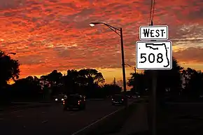
A sign denoting Florida State Road 508 during a sunset in Melbourne, Florida.
The entire route is in Melbourne, Brevard County.
| mi[1] | km | Destinations | Notes | ||
|---|---|---|---|---|---|
| 0.000 | 0.000 | Eddie Allen Road | Exit from Melbourne International Airport | ||
| 0.252 | 0.406 | ||||
| 0.640 | 1.030 | Babcock Street (CR 507) | |||
| 1.364 | 2.195 | ||||
| 1.000 mi = 1.609 km; 1.000 km = 0.621 mi | |||||
References
- 1 2 FDOT straight line diagrams Archived March 6, 2014, at the Wayback Machine, accessed March 2014
- ↑ Google (July 23, 2012). "Florida State Road 508" (Map). Google Maps. Google. Retrieved July 23, 2012.
External links
Template:Attached KML/Florida State Road 508
KML is not from Wikidata
 Media related to Florida State Road 508 at Wikimedia Commons
This article is issued from Wikipedia. The text is licensed under Creative Commons - Attribution - Sharealike. Additional terms may apply for the media files.