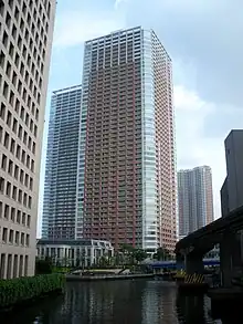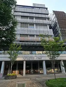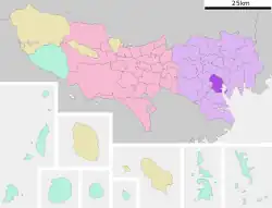

Shibaura (芝浦) is a district of Minato ward located in Tokyo, Japan. The district is located between the eastern side of the Yamanote Line train and Tokyo Bay. Shibaura consists mostly of artificial islands created by the excavation of industrial canals in the early 20th century. Formerly a light industrial area, it became famous for its night life during the Japanese asset price bubble period and, since the early 2000s, has become a high-rise residential district.
Economy
Shibaura is the home to a number of major Japanese corporations including:
- Toshiba (originally Tokyo Shibaura Electric)[1]
- SUMCO[2]
- Cosmo Oil Company[3]
- Mitsubishi Motors[4]
- THK[5]
- FamilyMart
- Yanase
- Bandai Namco Amusement
Rail links
The district is served by Tamachi Station on the Yamanote and Keihin-Tōhoku Lines, and by Shibaura-futō Station of the Yurikamome line. The Yokosuka Line also runs in a tunnel below the district, although there are no stops in the area.
Road links
The Tokyo Expressway system passes through the area, and the central Tokyo side of Route 11 connecting to the Rainbow Bridge[6] terminates at Shibaura Junction.
Education

Minato City Board of Education operates public elementary and junior high schools.
Shibaura 1 chōme 6-16 ban, Shibaura 2-3 chōme, and 4-chōme 20-22-ban are zoned to Shibahama Elementary School (芝浜小学校). Shibaura 4-chōme 1-19-ban are zoned to Shibaura Elementary School (芝浦小学校). The Shibahama Elementary and Shibaura Elementary zones feed into Konan Junior High School (港南中学校). Shibaura 1 chōme 1-5-ban are zoned to Shiba Elementary School (芝小学校) and Mita Junior High School (港区立三田中学校). [7]
 (芝浦小学校)
References
- ↑ "Corporate Data." Toshiba. Retrieved on September 26, 2014.
- ↑ "Corporate Data." SUMCO. Retrieved on September 26, 2014.
- ↑ "Company Profile." Cosmo Oil Company. Retrieved on March 28, 2015.
- ↑ "Corporate Profile - Mitsubishi Motors." Mitsubishi Motors. Retrieved on February 21, 2019.
- ↑ "Company Profile." THK. Retrieved on April 18, 2019.
- ↑ Kyodo (19 February 2016). "Rainbow Bridge's wondrous walkways harbor inner city views". National News. The Japan Times. Archived from the original on 30 August 2016. Retrieved 20 October 2017.
- ↑ "港区立小・中学校通学区域一覧表(令和4年4月以降)" (PDF). City of Minato. Retrieved 2022-10-08.
