| Satpara sar Lake سدپارہ سَر جھیل | |
|---|---|
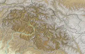
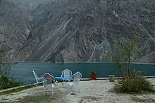
 The lake is set among the region’s spectacular mountainous landscapes | |
 Satpara sar Lake سدپارہ سَر جھیل | |
| Location | Skardu Valley |
| Coordinates | 35°13′46″N 75°37′49″E / 35.229521°N 75.630398°E |
| Basin countries | Pakistan |
| Max. length | 3.5 kilometres (2.2 mi) |
| Max. width | 1.4 kilometres (0.87 mi) |
| Islands | yes |
| Settlements | Skardu |
| Website | http://www.skardu.pk |
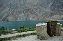
Sadpara Lake Skardu
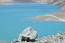
Turquoise water of Sadpara lake in Skardu
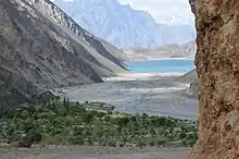
Sadpara lake view from village in Skardu
Sadpara Lake Skardu
.jpg.webp)
Sadpara Lake Skardu
Satpara sar Lake (Urdu: سدپارہ سر جھیل) is a natural lake near Skardu, Gilgit-Baltistan, Pakistan, which supplies water to Skardu Valley. It is fed by the Satpara Stream.
Satpara Lake is situated at an elevation of 2,636 meters (8,650 ft) above sea level and is spread over an area of 2.5 km².
The completion of Satpara Dam downstream of the lake has enlarged the size of Satpara Lake.[1]
Physical Features
- The melting ice of the Deosai plains are main source of water for the lake.
- The lake is centered with an area of 2.5 km with a picturesque island.[2]
See also
References
- ↑
- ↑ "Satpara Lake: Tourist Guide by Chukar". Chukar: Premium Leather Wallets. Retrieved 2017-04-10.
External links
Wikimedia Commons has media related to Satpara Lake.
This article is issued from Wikipedia. The text is licensed under Creative Commons - Attribution - Sharealike. Additional terms may apply for the media files.