This is a list of regions in the U.S. state of Oregon.
List
| Region | Location | Map | Principal communities | Population | Notes |
|---|---|---|---|---|---|
| Central Oregon | Deschutes, Crook, Jefferson counties | 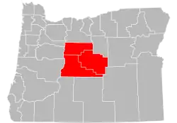 |
Bend, Redmond, Madras, Prineville | 219,564 (2015 est.)[1] |
Minimal definition. Sometimes includes north to the Columbia River and south to the border with California. |
| Eastern Oregon | Baker, Grant, Harney, Malheur, Morrow, Umatilla, Union, Wallowa counties |  |
Hermiston, Pendleton, La Grande, Ontario, Baker City | 181,137 (2015 est.)[1] |
Minimal definition. Sometimes includes west to the Cascade Range. |
| Northwest Oregon | Clatsop, Columbia, and Tillamook counties | 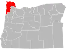 |
Astoria, St. Helens, Scappoose, Tillamook | 113,084 (2015 est.)[1] |
Minimal definition. Sometimes includes parts of Washington County. |
| Southeastern Oregon/Oregon Outback | Harney, Klamath, Lake, and Malheur counties | 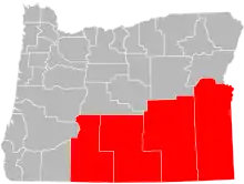 |
Klamath Falls, Lakeview, Burns, Ontario | 111,425 (2015 est.)[1] |
|
| Southern Oregon | Douglas, Jackson, Josephine, and Klamath counties | 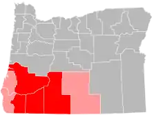 |
Medford, Grants Pass, Roseburg, Klamath Falls | 471,013 (2015 est.)[1] |
Minimal definition. Sometimes includes Coos, Curry, and Lake counties. |
| Western Oregon | West of the Cascades, Lane County and north | 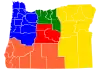 |
Portland, Salem, Eugene | 3,010,021 (2015 est.)[1] |
Minimal definition. Sometimes includes Southern Oregon. Area on the map highlighted in blue. |
| Applegate Valley | Southwestern Jackson and eastern Josephine counties along the Applegate River |  |
Applegate, Ruch | Not available | |
| Cascade Range | Cascade Mountains | 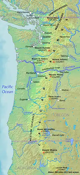 |
N/A | Not available | |
| Catlow Valley | Southwestern Harney County | 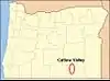 |
Blitzen (formerly) | Not available | |
| Columbia Plateau | Northeastern area around the Columbia River | 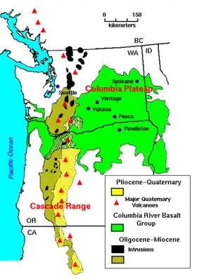 |
Hermiston, Hood River, Pendleton, The Dalles, Milton-Freewater | Not available | Area on the map highlighted in green. Partly in Washington. |
| Columbia River Gorge | Parts of Multnomah, Hood River, and Wasco counties | 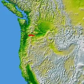 |
Hood River, The Dalles | Not available | |
| Eagle Valley | Eastern Baker County | 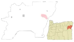 |
Richland, New Bridge, Sparta | Not available | |
| French Prairie | Northern Marion County | 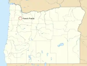 |
Woodburn, Aurora, Butteville, Donald, Gervais, Hubbard, Saint Louis, St. Paul | Not available | |
| Goose Lake Valley | Southern Lake County | 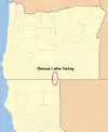 |
Lakeview | 7,829 (Lake County 2015 est.)[1] |
Partly in California. |
| Harney Basin | Northern and central Harney County |  |
Burns, Hines | 7,200 (Harney County 2015 est.)[1] |
|
| High Desert | Southeastern Oregon | 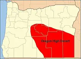 |
Bend, Burns, Lakeview, Prineville, Redmond | Not available | |
| Hood River Valley | Hood River County | 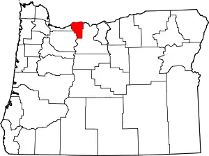 |
Hood River | 23,137 (Hood River County 2015 est.)[1] |
|
| Klamath Basin | Southern Klamath County | 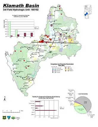 |
Klamath Falls, Altamont | 66,016 (Klamath County 2015 est.)[1] |
Also extends into California. |
| Mount Hood Corridor | Clackamas County along U.S. 26 | Government Camp, Mount Hood Village, Sandy | Not available | ||
| Oregon Coast | Areas bordering the Pacific Ocean |  |
Astoria, Tillamook, Lincoln City, Newport, Florence, Coos Bay, Brookings | Not available | Itself divided into three sub-regions, highlighted on map. |
| Portland metropolitan area | Area around Portland |  |
Portland, Gresham, Hillsboro, Beaverton | 1,918,394 (2015 est.)[1][2] |
Also includes parts of Southwest Washington |
| Rogue Valley | Along the Rogue River in Jackson and Josephine counties | 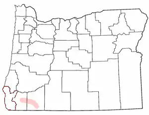 |
Medford, Ashland, Grants Pass | 297,312 (Jackson/Josephine counties, 2015 est.)[1] |
|
| Treasure Valley | Along the Snake River in northeastern Malheur County |  |
Ontario, Nyssa, Vale | Not available | Mostly in Idaho. |
| Trout Creek Mountains | Southern Malheur and Harney counties |  |
McDermitt | Not available | Partly in Nevada. |
| Tualatin Valley | Along the Tualatin River in Washington and Clackamas counties | 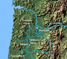 |
Tigard, Tualatin, Sherwood, Beaverton, Aloha, Hillsboro, Forest Grove, West Linn | Not available | |
| Umpqua Valley | Douglas County | 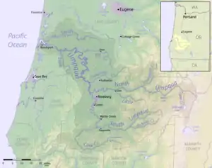 |
Roseburg | Not available | |
| Wallowa Valley | Wallowa County along the Wallowa River | 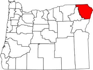 |
Enterprise, Joseph, Lostine, Wallowa | 6,856 (Wallowa County 2015 est.)[1] |
|
| Warner Valley | Southeastern Lake County around the Warner Lakes |  |
Adel, Plush | Not available | |
| Willamette Valley | Area along the Willamette River | 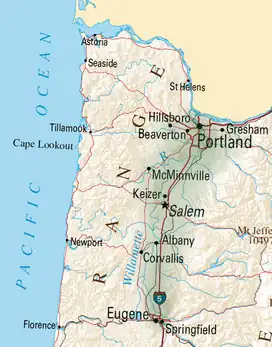 |
Portland, Salem, Albany, Corvallis, Eugene | Not available |
See also
References
This article is issued from Wikipedia. The text is licensed under Creative Commons - Attribution - Sharealike. Additional terms may apply for the media files.