Prinzapolka | |
|---|---|
Municipality | |
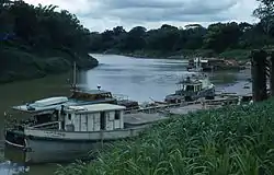 Town of Alamikamba at the shores of the Prinzapolka River | |
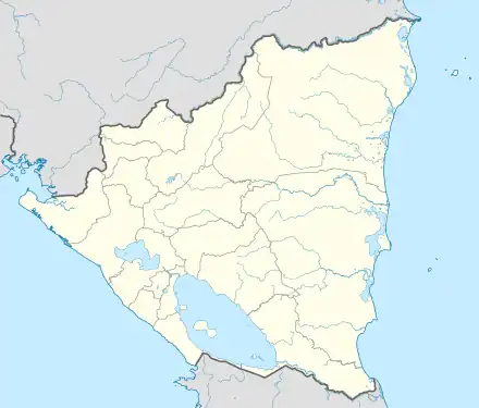 Prinzapolka Location in Nicaragua | |
| Coordinates: 13°24′N 83°34′W / 13.400°N 83.567°W | |
| Country | |
| Department | North Caribbean Coast Autonomous Region |
| Area | |
| • Municipality | 7,020 km2 (2,710 sq mi) |
| Population (2005) | |
| • Municipality | 16,105 |
| • Density | 2.3/km2 (5.9/sq mi) |
| • Urban | 1,689 |
| Time zone | UTC-6 (Central Time) |
| • Summer (DST) | UTC-6 (No DST) |
| Climate | Af |
Prinzapolka (Spanish pronunciation: [pɾinsaˈpolka]) is a Miskito municipality in the North Caribbean Coast Autonomous Region of Nicaragua.
Prinzapolka (sometimes spelled Prinzapolca) is also an important river and river basin in the Caribbean Coast Region of Nicaragua.
Language
Miskito language is dominant in the region, followed by Mayangna and Spanish.
Culture
Since Prinzapolka is a Miskito municipality, Miskito culture is dominant, but there are also Latinos and Mayangnas.
External links
- To view more photos of Prinzapolka taken in the late 1950s, go to this site: https://web.archive.org/web/20100117035333/http://picasaweb.google.com/JimDrebert/SiunaNicaragua1955To1961
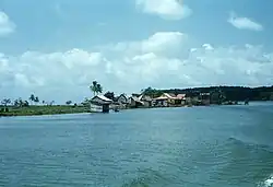
Town of Prinzapolka town viewed from the Prinazpolka River near its mouth on the Caribbean Sea
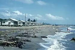
View of Puerto Isabel dock 5 km (3 mi) south of Prinzapolka and beach cabins belonging to La Luz Gold Mine in Siuna and Bonanza and Rosita

Photo of Puerto Isabel dock owned by La Luz Gold Mine in Siuna and Bonanza and Rosita
Capital: Puerto Cabezas | ||
| Municipalities |  | |
This article is issued from Wikipedia. The text is licensed under Creative Commons - Attribution - Sharealike. Additional terms may apply for the media files.