< Portal:Michigan highways < Selected picture 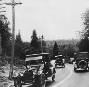
Credit: Federal Highway Administration
Marquette–Negaunee Road along Dead Man's Curve in 1917 with the first highway centerline in the country
Recently selected: Capitol Loop • M-39 • M-28/M-64
This article is issued from Wikipedia. The text is licensed under Creative Commons - Attribution - Sharealike. Additional terms may apply for the media files.