< Portal:Michigan highways < Selected picture 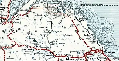
A section of the 1932 Official Michigan Highway Map, showing the planned M-35 in the Huron Mountains between Big Bay and L'Anse
This article is issued from Wikipedia. The text is licensed under Creative Commons - Attribution - Sharealike. Additional terms may apply for the media files.