The California Roads Portal
The highway system of California is a network of roads owned and maintained by the state of California through the California Department of Transportation (Caltrans). Most of these are numbered in a statewide system, and are known as State Route X (abbreviated SR X). United States Numbered Highways are labeled US X, and Interstate Highways are Interstate X, though Caltrans typically uses State Route X for all classes.
.svg.png.webp)
Interstate Highways and U.S. Highways are assigned at the national level. Interstate Highways are numbered in a grid—even-numbered routes are east–west routes (with the lowest numbers along Mexico and the Gulf of Mexico), and odd-numbered routes are north–south routes (with the lowest numbers along the Pacific Ocean). U.S. Highways are also numbered in a grid—even numbered for east–west routes (with the lowest numbers along Canada) and odd numbered for north–south routes (with the lowest numbers along the Atlantic Ocean). There are 21 Interstate Highways in California, ranging from Interstate 5 to Interstate 980. There are seven current U.S. Highways including U.S. Route 6 and U.S. Route 395.


California State Routes are managed by Caltrans and designated by the California State Legislature. The state route's signs are in the shape of a miner's spade to honor the California Gold Rush. Each state highway in the U.S. state of California is assigned a Route (officially State Highway Route) number in the Streets and Highways Code (Sections 300-635). Since July 1 of 1964, the majority of legislative route numbers, those defined in the Streets and Highways Code, match the sign route numbers. On the other hand, some short routes are instead signed as parts of other routes — for instance, State Route 112 and State Route 260 are signed as part of the longer State Route 61, and State Route 51 is part of Interstate 80 Business. California County Routes are marked with the usual County route shield, and are assigned a letter for where they are located. For instance, county highways assigned "S" are located in Southern California, ones assigned "J" are found in Central California, and those assigned "A" are located in Northern California.
Selected article
State Route 57 (SR 57), also known as the Orange Freeway, is a north–south state highway in the Greater Los Angeles Area of the U.S. state of California. It connects the interchange of Interstate 5 (I-5) and SR 22 near downtown Orange, locally known as the Orange Crush, with the Glendora Curve interchange with I-210 and SR 210 in Glendora. The highway provides a route across several spurs of the Peninsular Ranges, linking the Los Angeles Basin with the Pomona Valley and San Gabriel Valley. A predecessor to this road ran through Brea Canyon by the early 20th century, and was added to the state highway system. The freeway was built in stages during the 1950s, one of which included the Brea Canyon Freeway; SR 57 was subsequently designated as part of the 1964 state highway renumbering. The final portion of the Orange Freeway that has been completed to date was not built until the early 1970s. The latest piece of SR 57 to be added was formerly part of I-210, after SR 210 was extended to San Bernardino in 1998. An unconstructed extension from Santa Ana south to Huntington Beach remains in the legal definition of Route 57, and has been studied most recently as a toll road above the Santa Ana River.
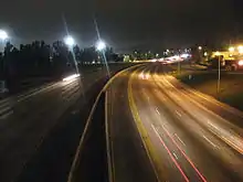
Selected image

Related portals
Did you know...
- ...that scenic State Route 160 crosses California's Sacramento River twice on 1923 bascule bridges (one pictured) patented by Joseph B. Strauss, who went on to design the Golden Gate Bridge?
- ...that the Sierra Highway was described in a promotional book to recruit teachers to California as "a highway with a hundred by-ways, each by-way with a hundred wonders"?
- ...that Alameda Street was built by Los Angeles County, California as a "truck boulevard" to the port?
Subcategories
WikiProjects
- Main projects
![]()
- Highways • United States • California • U.S. Roads • U.S. Streets • California State Routes
- Related projects
- Los Angeles • San Diego • Southern California • Santa Barbara County • Inland Empire • San Francisco Bay Area
Quality content
| This is a list of recognized content, updated weekly by JL-Bot (talk · contribs) (typically on Saturdays). There is no need to edit the list yourself. If an article is missing from the list, make sure it is tagged or categorized (e.g. Category:California road transport articles) correctly and wait for the next update. See WP:RECOG for configuration options. |
Featured articles
Good articles
 Arroyo Seco Parkway
- Bayshore Freeway
- California State Route 3
- California State Route 7
- California State Route 11
- California State Route 14
- California State Route 16
- California State Route 20
- California State Route 37
- California State Route 46
- California State Route 47
- California State Route 54
- California State Route 55
- California State Route 70
- California State Route 88
- California State Route 98
- California State Route 115
- California State Route 125
- California State Route 133
- California State Route 139
- California State Route 149
- California State Route 160
- California State Route 174
- California State Route 177
- California State Route 186
- California State Route 188
- California State Route 190
- California State Route 195
- California State Route 198
- California State Route 209
- California State Route 243
- California State Route 244
- California State Route 247
- California State Route 266
- California State Route 275
- California State Route 282
- California State Route 905
- Interstate 205 (California)
- Interstate 680 (California)
- Interstate 780
- Sierra Highway
- U.S. Route 50 in California
- U.S. Route 80 in California
- U.S. Route 199
- U.S. Route 395 in California
Things you can do

- Improve all California roadways articles to good article or featured article status
- Add reliably sourced content and make sure facts are verifiable
Wikimedia
The following Wikimedia Foundation sister projects provide more on this subject:
-
 Commons
Free media repository -
 Wikibooks
Free textbooks and manuals -
 Wikidata
Free knowledge base -
 Wikinews
Free-content news -
 Wikiquote
Collection of quotations -
 Wikisource
Free-content library -
 Wikiversity
Free learning tools -
 Wiktionary
Dictionary and thesaurus
-
 List of all portals
 -

-

-

-

-

-

-

-

-

-
 Random portal
 -
 WikiProject Portals