No Man's Land Navy Airfield | |||||||||||
|---|---|---|---|---|---|---|---|---|---|---|---|
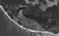 USGS photo of Noman's Land with the field visible in the Southwest corner | |||||||||||
| Summary | |||||||||||
| Airport type | Military: Airfield | ||||||||||
| Operator | United States Navy | ||||||||||
| Location | Nomans Land, Massachusetts | ||||||||||
| Built | 1943 | ||||||||||
| In use | 1943-1950s | ||||||||||
| Occupants | Navy | ||||||||||
| Elevation AMSL | 37 ft / 11 m | ||||||||||
| Coordinates | 41°15′12.8″N 070°49′25.04″W / 41.253556°N 70.8236222°W | ||||||||||
| Runways | |||||||||||
| |||||||||||
Closed To All Aviation Traffic | |||||||||||
No Man's Land Navy Airfield was an operational United States Navy airfield from 1943 to 1950s. The airfield is located on Nomans Land island, about three miles (5 km) off the southwest corner of the island of Martha's Vineyard, Massachusetts.[1] When it was rarely used, it was only to support propeller aircraft.[1]
See also
References
- 1 2 Freeman, Paul (February 22, 2009). "Abandoned & Little-Known Airfields: Southeastern Massachusetts". Abandoned & Little-Known Airfields. Retrieved 2009-04-12.
This article is issued from Wikipedia. The text is licensed under Creative Commons - Attribution - Sharealike. Additional terms may apply for the media files.