 | ||||
|---|---|---|---|---|
Map of the National Highway in red | ||||
 NH 75 route in Karnataka | ||||
| Route information | ||||
| Length | 533 km (331 mi) | |||
| Major junctions | ||||
| West end | Bantval, Karnataka | |||
| East end | Vellore, Tamil Nadu | |||
| Location | ||||
| Country | India | |||
| States | Karnataka, Andhra pradesh, Tamil Nadu | |||
| Primary destinations | Uppinangady, Sakleshpur, Hassan, Kunigal, Nelamangala, Bengaluru, Kolar, Mulbagal, Venkatagirikota, Pernambut, Gudiyattam, Katpadi | |||
| Highway system | ||||
| ||||
National Highway 75 (NH 75) is one of major National Highway in India. passing through states of Karnataka, Andhra Pradesh, and Tamil Nadu.[1][2] This national highway was earlier known as National Highway 48 (NH-48) before rationalisation of highway numbers in 2010. The highway connects the port city of Mangaluru (Mangalore) in the west to the city of Vellore in the east.[3] National highway 75 is the main road for travellers from Mangaluru going to Bengaluru and Hassan. NH-75 traverses all three geographical regions of Karnataka state namely Karavali, Malenadu and Bayaluseeme.[4]
Renamed roads
Route
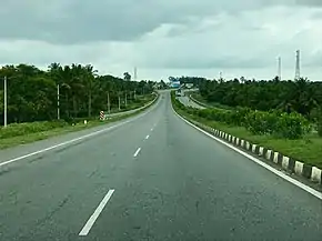
.jpg.webp)
It starts at Bantwal in Karnataka state and passes through Nellyadi, Shiradi ghat, Sakleshpura, Hassan, Yediyur, Kunigal, Bengaluru, Kolar, Mulbagal, Venkatagirikota, Pernambut, Gudiyattam, Katpadi before terminating at Vellore in Tamil Nadu.[2] This highway bypasses Hassan and Kunigal main town area.
State–wise route length in km.[5]
- Karnataka - 418.7 km (260.2 mi)
- Andhra Pradesh – 23.40 km (14.54 mi)[2]
- Tamil Nadu - 60.7 km (37.7 mi)
Junctions
See also
References
- ↑ "New Numbering of National Highways notification - Government of India" (PDF). The Gazette of India. Retrieved 11 April 2019.
- 1 2 3 "List of National Highways passing through A.P. State". Roads and Buildings Department. Government of Andhra Pradesh. Archived from the original on 28 March 2016. Retrieved 11 February 2016.
- ↑ "National Highway 48". Maps of India. Retrieved 5 November 2019.
- ↑ "Shiradi ghat will be closed to heavy vehiclesfor six months". The Deccan Chronicle. Retrieved 1 September 2018.
- ↑ "State-wise length of National Highways (NH) in India". Ministry of Road Transport and Highways India. Retrieved 11 April 2019.
External links


Secondary routes of National Highway 75 | ||
|---|---|---|
| ||
| Secondary Routes of NH 75 | ||