U.S. Highway 20 | ||||
|---|---|---|---|---|
US 20 highlighted in red | ||||
| Route information | ||||
| Maintained by ODOT | ||||
| Length | 451.25 mi[1] (726.22 km) | |||
| Existed | 1940–present | |||
| Major junctions | ||||
| West end | ||||
| East end | ||||
| Location | ||||
| Country | United States | |||
| State | Oregon | |||
| Counties | Lincoln, Benton, Linn, Jefferson, Deschutes, Lake, Harney, Malheur | |||
| Highway system | ||||
| ||||

U.S. Route 20 (US 20) is a major west–east cross-state highway in the northern part of the U.S. state of Oregon, especially east of the Cascade Mountains. It connects U.S. Route 101 in Newport on the central Oregon Coast to the Idaho state line east of Nyssa.
Route description
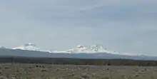
US 20 starts at an intersection with US 101 in Newport, and travels eastward over the Central Oregon Coast Range to Corvallis. In Corvallis, it intersects Oregon Route 99W (OR 99W) and briefly travels concurrent with OR 34 before proceeding northeast to Albany. From Albany, US 20 briefly travels concurrent with OR 99E before turning east through Lebanon and Sweet Home and entering the Cascade Mountains. It intersects OR 126 west of Santiam Pass and the two routes travel concurrent through Sisters. US 20 then continues eastward and southward to Bend, where it travels roughly parallel to US 97 for about 3 miles (4.8 km) before turning east through Brothers and Riley. At Riley, US 20 travels concurrent with US 395 through Hines and Burns to about 2 miles (3.2 km) northeast of Burns. From Burns, US 20 continues east through Juntura and Vale. In Vale, US 20 travels concurrent with US 26, and the two highways continue east to Cairo Junction, south of Ontario, and turn south, where they then also travel concurrently with OR 201 to Nyssa. Eastward from Nyssa, US 20/US 26 continue to the Idaho state line. The route throughout most of Oregon serves as an important link between Central and Southern Oregon and far Northern California to Boise, Idaho.
History
Under the initial 1925 plan for the United States Numbered Highway System, US 20 was originally planned to follow the Columbia River from Astoria to Pendleton and continue southeast into Idaho. The Oregon Highway Commission requested that US 30 be assigned to the Columbia River Highway instead and have US 20 truncated at Pocatello, Idaho. The American Association of State Highway Officials ultimately agreed to truncate US 20 further to Yellowstone National Park, but later extended it via central Oregon in 1940.[2]
A 10-mile (16 km) section of the Corvallis–Newport Highway between Chitwood to Eddyville was replaced by the Oregon Department of Transportation (ODOT) in the early 21st century to accommodate higher traffic volumes. The section, originally opened in 1917, was winding and had no shoulder for vehicle breakdowns. Construction on a straighter, 5.5-mile (8.9 km) route began in 2005 and was planned to be completed in 2009, but landslides and other hazards caused delays.[3] In 2012, ODOT took over the project from the original design–build contractor after an agreement was reached in their liability dispute. The project was completed in October 2016 at a cost of $365 million.[4][5]
In 2017, the Oregon legislature designated Oregon’s 451-mile stretch of U.S. Route 20 as the state’s official Medal of Honor Highway. Twelve roadside signs were placed along the route to honor Oregon’s Medal of Honor recipients. Oregon was the first state to designate a border-to-border route as its official Medal of Honor Highway. Supporters hope other states will extend the Medal of Honor designation from the Oregon border to highway’s eastern terminus in Massachusetts.[6]
Oregon highway designations
The Oregon section of US 20 consists of the following highways numbered using ODOT's internal numbering system (see Oregon highways and routes), from west to east:
- The Corvallis-Newport Highway No. 33;
- Part of the Corvallis-Lebanon Highway No. 210;
- The Albany-Corvallis Highway No. 31;
- The Santiam Highway No. 16;
- Part of the McKenzie Highway No. 15;
- The McKenzie-Bend Highway No. 17;
- The Central Oregon Highway No. 7.
Major intersections
Milepoints are as reported by ODOT and do not necessarily reflect current mileage. Z indicates overlapping mileage due to construction longer than established route, and – indicates negative mileage behind established beginning point.[7] Segments that are locally maintained may be omitted. For routes traversing multiple named state highways, each milepoint is preceded by the corresponding state highway number.
| County | Location[8] | Milepoint[8] | Destinations | Notes | ||||
|---|---|---|---|---|---|---|---|---|
| Lincoln | Newport | 33 0.00 | ||||||
| | 33 5.62 | |||||||
| | 33 5.74 | |||||||
| | 33 7.49 | |||||||
| | 33 10.34 | Pioneer Mountain summit, elevation 377 feet (115 m) | ||||||
| | 33 23.18 | |||||||
| | 33 31.08 | Cline Hill summit, elevation 770 feet (230 m) | ||||||
| Benton | | 33 38.28 | Dudley Hill summit, elevation 860 feet (260 m) | |||||
| | 33 39.39 | |||||||
| | 33 41.78 | Gellately Hill summit, elevation 789 feet (240 m) | ||||||
| | 33 44.57 | |||||||
| | 33 49.73 | Western end of concurrency with OR 34 | ||||||
| Corvallis | 33 55.67 91 (2)84.07 | Interchange; eastern end of concurrency with OR 34; eastbound exit and westbound entrance | ||||||
| Interchange; western end of concurrency with OR 99W; westbound exit and eastbound entrance | ||||||||
| 91 (2)83.42 210 –0.05 | Eastern end of concurrency with OR 99W | |||||||
| 210 0.00 31 0.10 | ||||||||
| Benton–Linn county line | Albany | 31 10.44 | Willamette River | |||||
| Linn | 31 11.28 58 2.25 | Western end of concurrency with OR 99E | ||||||
| 58 (2)1.45 16 –0.03 | Eastern end of concurrency with OR 99E; eastbound exit and westbound entrance | |||||||
| 16 1.04– 16 1.08 | Exit 233 on I-5 | |||||||
| | 16 6.55 | |||||||
| Lebanon | 16 12.80 | |||||||
| Sweet Home | 16 27.07 | |||||||
| 16 31.19 | Viewpoint (Foster Lake) | |||||||
| | 16 46.93 | Historical marker (Santiam Wagon Road) | ||||||
| | 16 63.64 | Tombstone Pass summit, elevation 4,236 feet (1,291 m) | ||||||
| | 16 71.52 | Western end of Route 126 concurrency | ||||||
| | 16 74.90 | |||||||
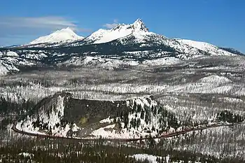
| Linn–Jefferson county line | | 16 80.77 | Santiam Pass summit, elevation 4,817 feet (1,468 m) | |||||
| Jefferson | | 16 84.57 | Viewpoint (Mount Washington) | |||||
| Deschutes | | 16 99.53 | Historical marker (Santiam Pass Road) | |||||
| Sisters | 16 100.12 15 Z92.03 | |||||||
| 15 93.07 17 0.00 | Eastern end of concurrency with OR 126 | |||||||
| | 17 9.09– 17 9.18 | Viewpoint | ||||||
| Bend | 17 18.51 | Interchange; western end of concurrency with US 97 Bus. | ||||||
| 17 19.86 | Interchange; eastbound exit only | |||||||
| Interchange; westbound exit only | ||||||||
| 17 20.99 7 0.51 | Eastern end of concurrency with US 97 Bus. | |||||||
| | 7 19.95 | Historical marker (prehistoric river) | ||||||
| | 7 20.56 | Horse Ridge summit, elevation 4,291 feet (1,308 m) | ||||||
| | 7 35.65 | |||||||
| Lake |
No major junctions | |||||||
| Harney | | 7 103.03 | Historical marker (Bannock War) | |||||
| | 7 104.69 | Western end of concurrency with US 395 | ||||||
| Burns | 7 131.50 | |||||||
| | 7 134.29 | Eastern end of concurrency with US 395 | ||||||
| | 7 144.25 | Historical marker (Fort Harney) | ||||||
| | 7 155.09 | Historical marker (Great Basin) | ||||||
| | 7 160.79 | Stinkingwater Pass, elevation 4,848 feet (1,478 m) | ||||||
| | 7 177.54 | Drinkwater Pass, elevation 4,212 feet (1,284 m) | ||||||
| Malheur | | 7 232.99 | Vines Hill summit, elevation 2,886 feet (880 m) | |||||
| | 7 238.78 | Graham Boulevard (Vale–West Highway No. 451) – Bully Creek Reservoir | ||||||
| Vale | 7 245.46 | Graham Boulevard (Vale–West Highway No. 451) | ||||||
| 7 246.39 | Western end of concurrency with US 26 | |||||||
| | 7 253.48 | Viewpoint (Trenkel Hill vista) | ||||||
| Cairo Junction | 7 258.20 | Western end of concurrency with OR 201 | ||||||
| Nyssa | 7 265.97 | Eastern end of Route 201 concurrency | ||||||
| 7 266.82 | Continuation into Idaho across Snake River | |||||||
1.000 mi = 1.609 km; 1.000 km = 0.621 mi
| ||||||||
Special routes
US 20 has 2 business routes in Oregon: one in Toledo, and one in Bend.
See also
References
- ↑ "US Route 20 in Oregon".
- ↑ Weingroff, Richard. "What Is The Longest Road in the United States?". Federal Highway Administration. Retrieved September 13, 2021.
- ↑ "U.S. 20 Pioneer Mountain to Eddyville Project: Background and History" (PDF). Oregon Department of Transportation. p. 1. Retrieved March 7, 2021.
- ↑ Lehman, Chris (October 11, 2016). "Oregon Finishes Road Replacement 10 Years Later, $220 Million Over Budget". Oregon Public Broadcasting. Retrieved January 30, 2017.
- ↑ Day, James (March 13, 2016). "Long-delayed Highway 20 project in final stages". Corvallis Gazette-Times. Retrieved March 7, 2021.
- ↑ Warner, Gary A., "Medal of Honor Highway saluted near Bend", The Bulletin, Bend, Oregon, 16 January 2018.
- ↑ Road Inventory and Classification Services (July 2017). "Straightline Chart Legend" (PDF). Oregon Department of Transportation. Retrieved April 7, 2018.
- 1 2 Road Inventory and Classification Services Unit. "Straightline Charts". Transportation Development Division, Oregon Department of Transportation. Retrieved September 22, 2016.
- Corvallis–Newport Highway No. 33 (September 2013)
- Pacific Highway West Highway No. 1W(91) (July 2014)
- Corvallis–Lebanon Highway No. 210 (November 2011)
- Albany–Corvallis Highway No. 31 (February 2012)
- Albany–Junction City Highway No. 58 (March 2016)
- Santiam Highway No. 16 (August 2015)
- McKenzie Highway No. 15 (December 2011)
- McKenzie–Bend Highway No. 17 (November 2014)
- Central Oregon Highway No. 7 (July 2015)
External links
 Media related to U.S. Route 20 in Oregon at Wikimedia Commons
- U.S. 20: Route crosses the Cascades and heads east - The Oregonian