| Llanellen | |
|---|---|
 | |
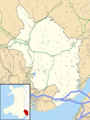 Llanellen Location within Monmouthshire | |
| Principal area | |
| Preserved county | |
| Country | Wales |
| Sovereign state | United Kingdom |
| Post town | USK |
| Postcode district | NP |
| Police | Gwent |
| Fire | South Wales |
| Ambulance | Welsh |
| UK Parliament | |
Llanellen (Welsh: Llanelen) is a village in Monmouthshire, south-east Wales, United Kingdom. It is located three miles (4.8 km) south of Abergavenny. The population was 506 in 2011.[1]
Geography

The Blorenge mountain towers above the village. The River Usk passes close by, crossed by a bridge built in 1821 by John Upton,[2] who also built the nearby Pant-y-Goitre Bridge. The Monmouthshire and Brecon Canal passes through Llanellen.
History and amenities
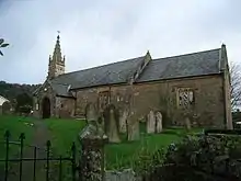
The church of St Helen possibly dates back to the 13th century, though the church was largely re-built in Perpendicular style in the mid-19th century by architect John Prichard.[3] In the churchyard is the grave of Sir Thomas Phillips, Mayor of Newport at the time of the Newport Rising in 1839, and a prominent defender of Welsh language and education,[4] who lived in nearby Llanellen House.
References
- ↑ "Custom report - Nomis - Official Labour Market Statistics".
- ↑ "Llanellen Bridge, Llanover". British Listed Buildings.
- ↑ "St Helen's Church, Llanellen (420845)". Coflein. RCAHMW. Retrieved 12 August 2019.
- ↑ Olding, Frank (7 January 2016). "Llanellen's almost forgotten hero of the Welsh language". Abergavenny Chronicle. Retrieved 12 August 2019.