The 78 official neighborhoods of the City and County of Denver.
The City and County of Denver, capital of the U.S. state of Colorado, has 78 official neighborhoods as of January 2013.[1] In addition to the official administrative neighborhoods, many residents have names for local neighborhoods that may not conform to the boundaries of official neighborhoods. Denver does not have any official larger area designations, unlike the City of Chicago for example, which has larger areas that house the neighborhoods (IE: Northwest Side). Denver residents use the terms "north" "south" "east" and "west" loosely, and the neighborhoods as categorized below reflect this.[2]
Central
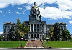
Colorado State Capitol Building, at the western edge of the Capitol Hill neighborhood
East
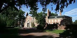
The Phipps Mansion in the Belcaro neighborhood.
- Belcaro
- Cory-Merrill
- East Colfax
- Hale
- Hilltop
- Indian Creek
- Lowry
- Montclair
- Park Hill
- Virginia Village
- Washington Virginia Vale
- Windsor
North
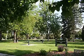
Russell Square Park in the Cole Neighborhood.
- Clayton
- Cole
- Elyria-Swansea
- Five Points
- Globeville
- North Park Hill
- Skyland
- South Park Hill
- Whittier
Northeast
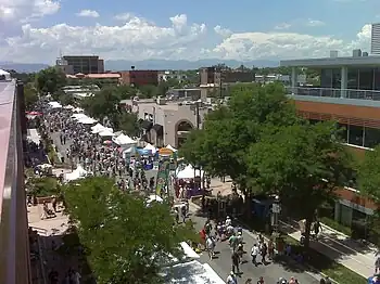
July 4th Arts Festival in the Cherry Creek commercial district
- Central Park
- Denver International Airport
- Gateway/Green Valley Ranch
- Montbello
- Northeast Park Hill
Northwest
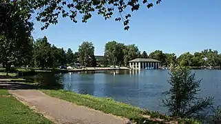
A flock of Canada geese on the frozen surface of Sloan's Lake in winter. Rocky Mountains are in the background.
- Auraria
- Berkeley
- Chaffee Park
- Highland
- Jefferson Park
- Regis
- Sloan Lake
- Sunnyside
- West Highland
South
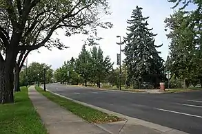
Washington Park
- College View/South Platte
- Overland
- Platt Park
- Rosedale
- University
- University Hills
- University Park
- Washington Park
- Washington Park West
- Wellshire
Southeast
- Goldsmith
- Hampden
- Hampden South
- Kennedy
- Southmoor Park
Southwest
- Bear Valley
- Fort Logan
- Harvey Park
- Harvey Park South
- Marston
West
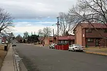
Public housing in Sun Valley.
- Athmar Park
- Barnum
- Barnum West
- Mar Lee
- Ruby Hill
- Sun Valley
- Valverde
- Villa Park
- West Colfax
- Westwood
Non-official Neighborhoods
The Alamo Placita neighborhood is named for Alamo Placita Park. The street in the foreground is the northbound part of Speer Boulevard.
- Alamo Placita – A historic district, part of the larger Speer neighborhood.
- Ballpark District – An active area that includes Coors Field and several blocks east, part of the Five Points neighborhood.
- Burns Brentwood
- Crestmoor
- Curtis Park
- Golden Triangle – An area which incorporates many of Denver's civic and cultural institutions, roughly corresponds with the Civic Center neighborhood.
- Hampden Heights
- LoDo – Original settlement of Denver, with many of its oldest buildings and is known for its nightlife, overlaps parts of the Union Station and Five Points neighborhoods.
- Mayfair
- Parkfield
- RiNo
- Northside
- South Denver
- Uptown – Roughly corresponds with North Capitol Hill neighborhood.
See also
References
- ↑ "Denver Statistical Neighborhood Boundaries map" (PDF). DenverGov. Archived from the original (PDF) on 2015-02-18. Retrieved Oct 15, 2013.
- ↑ "Find A City To Love - Where to Live in Denver". MetroSeeker.com. Archived from the original on 2013-08-29. Retrieved 2013-09-15.
External links
- The City and County of Denver
- List of Denver neighborhoods with descriptions, maps, homes – useful information for newcomers

This article is issued from Wikipedia. The text is licensed under Creative Commons - Attribution - Sharealike. Additional terms may apply for the media files.