| Mootwingee New South Wales | |||||||||||||||
|---|---|---|---|---|---|---|---|---|---|---|---|---|---|---|---|
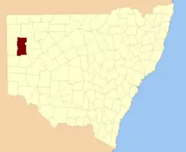 Location in New South Wales | |||||||||||||||
| |||||||||||||||
Mootwingee County, New South Wales is one of the 141 cadastral divisions of New South Wales.
Mootwingee is believed to be derived from a local Aboriginal word and is also the name of a nearby pastoral station, now a part of Mutawintji National Park; and of a landmark for the aboriginal people.[1]
Parishes
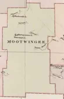
Mootwingee County, in a map from the Johns Sands 1886 Atlas of Australia.[2]
The parishes found within this county do not fall within a Local Government Area as the county lies within the Unincorporated Far West Region. A full list of the county's parishes and mapping coordinates to the approximate centre of each location is as follows:
References
- ↑ "Mootwingee County". Geographical Names Register (GNR) of NSW. Geographical Names Board of New South Wales.
- ↑ from John Sands, Atlas of Australia 1886.
This article is issued from Wikipedia. The text is licensed under Creative Commons - Attribution - Sharealike. Additional terms may apply for the media files.