| Clark's Lookout State Park | |
|---|---|
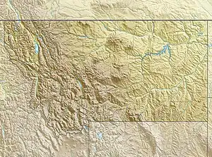
 Location in Montana | |
| Location | Beaverhead County, Montana, United States |
| Nearest city | Dillon, Montana |
| Coordinates | 45°14′10″N 112°37′53″W / 45.23611°N 112.63139°W[1] |
| Area | 8 acres (3.2 ha)[2] |
| Elevation | 4,337 ft (1,322 m)[1] |
| Designation | Montana state park |
| Established | 1985[3] |
| Administrator | Montana Fish, Wildlife & Parks |
| Website | Clark's Lookout State Park |
Clark's Lookout State Park is a Montana state park located one mile north of the community of Dillon. The 8-acre (3.2 ha) park encompasses the hill overlooking the Beaverhead River that William Clark climbed on August 13, 1805, during the Lewis and Clark Expedition. From the vantage point, Clark took various compass readings and sketched a map of the Beaverhead Valley.[4] The park offers picnicking, interpretive signage, and a chance to make the climb that Clark made and stand where he stood.[2]
References
- 1 2 "Clarks Lookout State Park". Geographic Names Information System. United States Geological Survey, United States Department of the Interior.
- 1 2 "Clark's Lookout State Park". Montana Fish, Wildlife & Parks. Retrieved October 22, 2012.
- ↑ "Park Origin by Date". Montana State Parks. 2014. Archived from the original on January 1, 2020. Retrieved June 4, 2018.
- ↑ Aarstad, Rich; et al. (2009). Montana Place Names from Alzada to Zortman. Helena, Montana: Montana Historical Society Press. p. 49. ISBN 9780975919613. Retrieved June 4, 2018.
External links
- Clark's Lookout State Park Montana Fish, Wildlife & Parks
- Clark's Lookout State Park Trail Map Montana Fish, Wildlife & Parks
This article is issued from Wikipedia. The text is licensed under Creative Commons - Attribution - Sharealike. Additional terms may apply for the media files.