| City of Norwood, Payneham & St Peters South Australia | |||||||||||||||
|---|---|---|---|---|---|---|---|---|---|---|---|---|---|---|---|
 | |||||||||||||||
| Population | 37,487 (LGA 2021)[1] | ||||||||||||||
| Established | 1997 | ||||||||||||||
| Area | 15.1 km2 (5.8 sq mi) | ||||||||||||||
| Mayor | Robert Bria [2] | ||||||||||||||
| Council seat | Norwood | ||||||||||||||
| Region | Eastern Adelaide[3] | ||||||||||||||
| State electorate(s) | Bragg, Dunstan, Hartley | ||||||||||||||
| Federal division(s) | Adelaide, Sturt | ||||||||||||||
.svg.png.webp) | |||||||||||||||
| Website | City of Norwood, Payneham & St Peters | ||||||||||||||
| |||||||||||||||

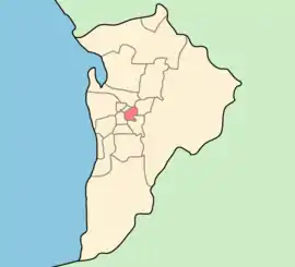
The City of Norwood Payneham & St Peters is a metropolitan local government area of South Australia. It covers the inner eastern suburbs of Adelaide. It is divided into five wards: Torrens, Payneham, West Norwood/Kent Town, Kensington (each electing two councillors), and Maylands/Trinity (three councillors).[2] The council is based at the historic Norwood Town Hall.[4] Comprising the council is a mayor and 13 elected members, who are supported by a chief executive, as well as four general managers and approximately 175 field and inside staff.[5]
History
It was established on 1 November 1997 with the amalgamation of the City of Kensington and Norwood, the City of Payneham and the Town of St Peters.[6][7] The original wards at its inception had been East Adelaide and Hackney, Stepney and Maylands, Torrens, Payneham, Trinity, Norwood/Kent Town and Kensington.[6]
Suburbs
Councillors
| Ward | Councillor | |
|---|---|---|
| Mayor [2] | Robert Bria | |
| Torrens Ward [2] | Hugh Holfeld | |
| Garry Knoblauch | ||
| Payneham Ward [2] | Josh Robinson | |
| Kevin Duke | ||
| West Norwood / Kent Town Ward [2] | Sue Whitington | |
| Grant Piggott | ||
| Kensington / East Norwood Ward[2] | John Callisto | |
| Christel Mex | ||
| Maylands / Trinity Ward [2] | Victoria McFarlane | |
| Connie Granozio | ||
| Scott Sims | ||
| St Peters Ward [2] | Claire Clutterham | |
| Kester Moorhouse | ||
The City of Norwood Payneham & St Peters has a directly elected mayor.[8]
See also
References
- ↑ Australian Bureau of Statistics (28 June 2022). "Norwood Payneham and St Peters (Local Government Area)". Australian Census 2021 QuickStats. Retrieved 28 June 2022.
- 1 2 3 4 5 6 7 8 9 "Mayor and Elected Members". City of Norwood Payneham & St Peters. Retrieved 12 December 2016.
- ↑ "Eastern Adelaide SA Government region" (PDF). The Government of South Australia. Archived from the original (PDF) on 27 March 2019. Retrieved 17 April 2017.
- ↑ "Contact us". City of Norwood Payneham & St Peters. Retrieved 13 December 2016.
- ↑ "About Council | City of Norwood Payneham & St Peters". www.npsp.sa.gov.au. Retrieved 14 October 2020.
- 1 2 "Our Logo". City of Norwood Payneham & St Peters. Archived from the original on 12 November 2016. Retrieved 12 November 2016.
- ↑ "Thursday, 24 April 1997" (PDF). The Government Gazette of South Australia. Government of South Australia. Retrieved 12 December 2016.
- ↑ "Election Results 2014" (PDF). Local Government Association of South Australia. Archived from the original (PDF) on 30 June 2007. Retrieved 14 February 2016.
External links
34°55′S 138°38′E / 34.917°S 138.633°E