This is a list of the National Register of Historic Places listings in Cuyahoga Valley National Park.
This is intended to be a complete list of the properties and districts on the National Register of Historic Places in Cuyahoga Valley National Park, Ohio, United States. The locations of National Register properties and districts for which the latitude and longitude coordinates are included below, may be seen in a Google map.[1]
There are 61 properties and districts listed on the National Register in the park, one of which is a National Historic Landmark.
This National Park Service list is complete through NPS recent listings posted January 12, 2024.[2]
Current listings
| [3] | Name on the Register | Image | Date listed[4] | Location | City or town | Description |
|---|---|---|---|---|---|---|
| 1 | Barker Village Site | 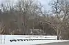 Barker Village Site |
April 19, 1978 (#78000379) |
Just north of the old railroad station at Botzum[5] 41°09′56″N 81°34′39″W / 41.165556°N 81.577500°W |
Cuyahoga Falls | Discovered when the Ohio and Erie Canal was constructed through the site[6] |
| 2 | Boston Mills Historic District | 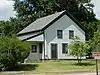 Boston Mills Historic District |
November 9, 1992 (#92001490) |
Roughly Riverview, Boston Mills, and Stanford Rds. and Main St. 41°15′52″N 81°33′34″W / 41.264444°N 81.559444°W |
Boston Township | |
| 3 | Botzum Farm | 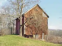 Botzum Farm |
October 21, 1999 (#99001271) |
3486 Riverview Rd. 41°10′29″N 81°34′54″W / 41.174722°N 81.581667°W |
Cuyahoga Falls | |
| 4 | Jim Brown House | 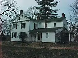 Jim Brown House |
March 2, 1979 (#79000299) |
South of Peninsula at 3491 Akron Peninsula Rd. 41°10′54″N 81°34′42″W / 41.181667°N 81.578333°W |
Cuyahoga Falls | |
| 5 | Jim Brown Tavern |  Jim Brown Tavern |
December 11, 1979 (#79000300) |
Boston Mills Rd. 41°15′48″N 81°33′31″W / 41.263333°N 81.558611°W |
Boston Township | |
| 6 | William Burt House |  William Burt House |
March 22, 1979 (#79000286) |
9525 Brecksville Rd. 41°18′10″N 81°37′36″W / 41.302778°N 81.626667°W |
Brecksville | |
| 7 | H. Karl Butler Memorial |  H. Karl Butler Memorial |
January 2, 1997 (#96001510) |
Truxell Rd., southeast of its junction with Peninsula Rd., Camp Manatoc 41°13′19″N 81°31′49″W / 41.221944°N 81.530278°W |
Boston Township | |
| 8 | Camp Manatoc Concord Lodge and Adirondacks Historic District | .tif.jpg.webp) Camp Manatoc Concord Lodge and Adirondacks Historic District |
January 2, 1997 (#96001513) |
Truxell Rd., southeast of its junction with Peninsula Rd., Camp Manatoc 41°13′07″N 81°31′46″W / 41.218611°N 81.529444°W |
Boston Township | |
| 9 | Camp Manatoc Dining Hall | 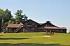 Camp Manatoc Dining Hall |
January 2, 1997 (#96001511) |
Truxell Rd., southeast of its junction with Peninsula Rd., Camp Manatoc 41°13′15″N 81°31′44″W / 41.220833°N 81.528889°W |
Boston Township | |
| 10 | Camp Manatoc Foresters Lodge and Kit Carson-Dan Boone Cabins Historic District | .tif.jpg.webp) Camp Manatoc Foresters Lodge and Kit Carson-Dan Boone Cabins Historic District |
January 2, 1997 (#96001514) |
Truxell Rd., southeast of its junction with Peninsula Rd., Camp Manatoc 41°13′39″N 81°31′58″W / 41.2275°N 81.532778°W |
Boston Township | |
| 11 | Camp Manatoc Legion Lodge | 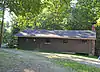 Camp Manatoc Legion Lodge |
January 2, 1997 (#96001512) |
Truxell Rd., southeast of its junction with Peninsula Rd., Camp Manatoc 41°13′07″N 81°31′46″W / 41.218611°N 81.529444°W |
Boston Township | |
| 12 | Albert Cofta Farmstead | 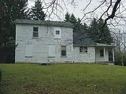 Albert Cofta Farmstead |
November 4, 2004 (#04001214) |
2966 Brush Rd., northeast of Richfield 41°15′13″N 81°36′56″W / 41.253611°N 81.615556°W |
Richfield Township | |
| 13 | Jonas Coonrad House | 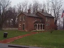 Jonas Coonrad House |
July 24, 1979 (#79000287) |
Southeast of Brecksville at 10340 Riverview Rd. 41°16′50″N 81°34′21″W / 41.280556°N 81.5725°W |
Brecksville | |
| 14 | Edward Cranz Farm | 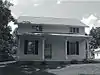 Edward Cranz Farm |
March 12, 1993 (#93000077) |
2780 Oak Hill Dr., south of Peninsula 41°11′50″N 81°35′31″W / 41.197222°N 81.591944°W |
Bath Township | |
| 15 | William and Eugene Cranz Farm | 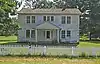 William and Eugene Cranz Farm |
March 12, 1993 (#93000078) |
2401 Ira Rd., south of Peninsula 41°11′15″N 81°35′31″W / 41.1875°N 81.591944°W |
Bath Township | |
| 16 | Michael Duffy Farm | 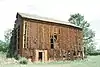 Michael Duffy Farm |
March 12, 1993 (#93000079) |
4965 Quick Rd., southeast of Peninsula 41°12′15″N 81°30′58″W / 41.204167°N 81.516111°W |
Boston Township | |
| 17 | Everett Historic District | 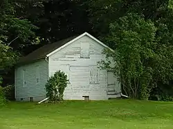 Everett Historic District |
January 14, 1993 (#93001467) |
4731-4642 Riverview Rd. and 2151-2279 Everett Rd., south of Peninsula, in the Cuyahoga Valley National Park 41°12′16″N 81°34′29″W / 41.204444°N 81.574722°W |
Boston Township | |
| 18 | Everett Knoll Complex |  Everett Knoll Complex |
May 25, 1977 (#77000157) |
Southern side of Everett Rd., west of its junction with Riverview Rd.[7] 41°12′16″N 81°34′33″W / 41.204306°N 81.575764°W |
Boston Township | |
| 19 | Stephen Frazee House | 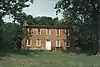 Stephen Frazee House |
May 4, 1976 (#76000211) |
7733 Canal Rd. 41°21′10″N 81°35′34″W / 41.352778°N 81.592778°W |
Valley View | |
| 20 | Furnace Run Aqueduct | 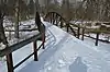 Furnace Run Aqueduct |
December 11, 1979 (#79000301) |
Furnace Run 41°12′06″N 81°34′22″W / 41.201667°N 81.572778°W |
Cuyahoga Falls | |
| 21 | Edmund Gleason House | 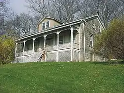 Edmund Gleason House |
December 18, 1978 (#78000377) |
7243 Canal Rd. 41°22′02″N 81°36′38″W / 41.367222°N 81.610556°W |
Valley View | |
| 22 | Hunt-Wilke Farm | 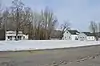 Hunt-Wilke Farm |
March 12, 1993 (#93000080) |
2049 Bolanz Rd. 41°12′04″N 81°34′19″W / 41.201111°N 81.571944°W |
Cuyahoga Falls | |
| 23 | Jaite Mill Historic District | 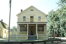 Jaite Mill Historic District |
May 21, 1979 (#79000288) |
Southeast of Brecksville at Riverview and Vaughan Rds. 41°17′10″N 81°34′06″W / 41.286111°N 81.568333°W |
Sagamore Hills Township | |
| 24 | Virginia Kendall State Park Historic District | 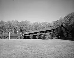 Virginia Kendall State Park Historic District |
January 2, 1997 (#96001515) |
701, 801, and 1000 Truxell Rd. and 434 W. Streetsboro, southeast of Peninsula 41°13′04″N 81°31′15″W / 41.217778°N 81.520833°W |
Boston Township | |
| 25 | William Knapp House | 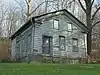 William Knapp House |
March 19, 1979 (#79000289) |
7101 Canal Rd. 41°22′20″N 81°36′42″W / 41.372222°N 81.611667°W |
Valley View | |
| 26 | Lock No. 26 | 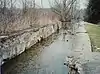 Lock No. 26 |
December 11, 1979 (#79000302) |
3.3 mi (5.3 km) north of Ira Rd. 41°11′08″N 81°34′53″W / 41.185556°N 81.581389°W |
Cuyahoga Falls | |
| 27 | Lock No. 27 | 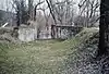 Lock No. 27 |
December 11, 1979 (#79000303) |
Approximately 400 ft (120 m) east of the intersection of Riverview and Everett Rds. at Everett 41°12′11″N 81°34′15″W / 41.203056°N 81.570833°W |
Boston Township | |
| 28 | Lock No. 28 | 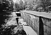 Lock No. 28 |
December 11, 1979 (#79000304) |
Deep Lock Q Quarry Metro Park 41°13′58″N 81°33′09″W / 41.232778°N 81.5525°W |
Peninsula | |
| 29 | Lock No. 29 and Aqueduct | 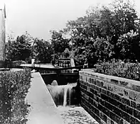 Lock No. 29 and Aqueduct |
December 11, 1979 (#79000305) |
Off State Route 303 41°14′34″N 81°33′02″W / 41.242778°N 81.550556°W |
Peninsula | |
| 30 | Lock No. 30 and Feeder Dam | 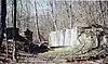 Lock No. 30 and Feeder Dam |
December 11, 1979 (#79000306) |
Off State Route 303 41°14′41″N 81°33′14″W / 41.244722°N 81.553889°W |
Peninsula | |
| 31 | Lock No. 31 | 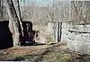 Lock No. 31 |
December 11, 1979 (#79000307) |
200 ft (61 m) east of the Cuyahoga River and approximately 0.5 mi (0.80 km) south of the Ohio Turnpike 41°15′06″N 81°32′46″W / 41.251667°N 81.546111°W |
Peninsula | |
| 32 | Lock No. 32 | 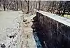 Lock No. 32 |
December 11, 1979 (#79000308) |
800 ft (240 m) north of Boston Mills 41°15′58″N 81°33′32″W / 41.266111°N 81.558889°W |
Boston Township | |
| 33 | Lock No. 33 | 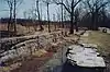 Lock No. 33 |
December 11, 1979 (#79000309) |
1 mi (1.6 km) south of Highland Rd. 41°16′36″N 81°33′40″W / 41.276667°N 81.561111°W |
Boston Township | |
| 34 | Lock No. 34 | 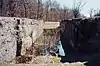 Lock No. 34 |
December 17, 1979 (#79000310) |
Highland Rd. 41°17′21″N 81°33′53″W / 41.289167°N 81.564722°W |
Sagamore Hills Township | |
| 35 | Lock No. 35 | 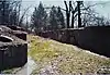 Lock No. 35 |
December 11, 1979 (#79000311) |
Off State Route 82 41°18′38″N 81°34′56″W / 41.310556°N 81.582222°W |
Sagamore Hills Township | |
| 36 | Lock No. 37 and Spillway | 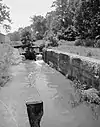 Lock No. 37 and Spillway |
December 11, 1979 (#79000290) |
Fitzwater Rd. 41°21′24″N 81°35′50″W / 41.356667°N 81.597222°W |
Valley View | |
| 37 | Lock No. 38 and Spillway | 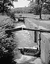 Lock No. 38 and Spillway |
December 11, 1979 (#79000291) |
Hillside Rd. 41°22′21″N 81°36′46″W / 41.372597°N 81.612792°W |
Valley View | |
| 38 | Lock No. 39 and Spillway | 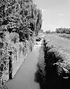 Lock No. 39 and Spillway |
December 11, 1979 (#79000292) |
Canal Rd. 41°23′25″N 81°37′30″W / 41.390278°N 81.625°W |
Valley View | |
| 39 | Lock Tender's House and Inn | 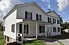 Lock Tender's House and Inn |
December 11, 1979 (#79000293) |
7104 Canal Rd. 41°22′21″N 81°36′47″W / 41.3725°N 81.613056°W |
Valley View | |
| 40 | Lutz-Martin Farm | 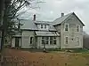 Lutz-Martin Farm |
July 3, 2003 (#03000608) |
2470 Martin Rd. 41°10′28″N 81°35′30″W / 41.174444°N 81.591667°W |
Bath Township | |
| 41 | Ohio and Erie Canal |  Ohio and Erie Canal |
November 13, 1966 (#66000607) |
State Route 631 41°22′14″N 81°36′59″W / 41.370556°N 81.616389°W |
Valley View | |
| 42 | Ohio and Erie Canal Deep Lock | 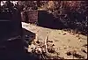 Ohio and Erie Canal Deep Lock |
September 9, 1974 (#74000345) |
South of Peninsula on Riverview Rd. 41°13′58″N 81°33′09″W / 41.232778°N 81.5525°W |
Peninsula | |
| 43 | Packard-Doubler House | 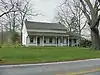 Packard-Doubler House |
March 9, 1979 (#79000294) |
7634 Riverview Rd. 41°21′18″N 81°36′12″W / 41.355°N 81.603333°W |
Independence | |
| 44 | Peninsula Village Historic District | 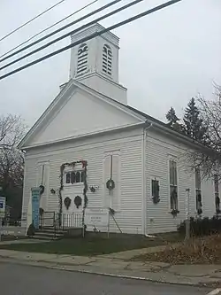 Peninsula Village Historic District |
August 23, 1974 (#74000346) |
Both sides of State Route 303 41°14′24″N 81°33′03″W / 41.24°N 81.550833°W |
Peninsula | |
| 45 | Nathaniel Point Farm | 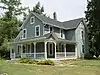 Nathaniel Point Farm |
September 3, 1999 (#99001084) |
4606 and 4631 Akron-Peninsula Rd., south of Peninsula 41°12′20″N 81°33′46″W / 41.205556°N 81.562778°W |
Boston Township | |
| 46 | Charles B. Rich House | 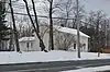 Charles B. Rich House |
February 22, 1979 (#79000295) |
9367 Brecksville Rd. 41°18′25″N 81°37′36″W / 41.306944°N 81.626667°W |
Brecksville | |
| 47 | Russ and Holland Snow Houses | 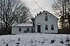 Russ and Holland Snow Houses |
September 28, 1982 (#82001873) |
12911 and 13114 Snowville Rd. 41°16′59″N 81°35′39″W / 41.283056°N 81.594167°W |
Brecksville | |
| 48 | South Park Site | 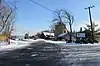 South Park Site |
June 22, 1976 (#76000212) |
On a promontory above the western bank of the Cuyahoga River, 7 miles from Lake Erie[8] 41°22′43″N 81°37′20″W / 41.3785°N 81.6222°W |
Independence | |
| 49 | George Stanford Farm | 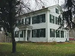 George Stanford Farm |
February 17, 1982 (#82001874) |
6093 Stanford Rd., north of Peninsula 41°16′16″N 81°33′25″W / 41.271111°N 81.556944°W |
Boston Township | |
| 50 | Station Road Bridge | .jpg.webp) Station Road Bridge |
March 7, 1979 (#79000312) |
East of Brecksville at the Cuyahoga River 41°19′10″N 81°35′16″W / 41.319444°N 81.587778°W |
Sagamore Hills Township | |
| 51 | Stebbens Farm | 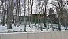 Stebbens Farm |
April 17, 1996 (#96000381) |
8255 Riverview Rd. 41°20′19″N 81°35′40″W / 41.338611°N 81.594444°W |
Brecksville | |
| 52 | Stumpy Basin |  Stumpy Basin |
December 11, 1979 (#79000313) |
200 ft (61 m) east of the Cuyahoga River and approximately 0.5 mi (0.80 km) south of the Ohio Turnpike, north of Peninsula 41°15′09″N 81°32′45″W / 41.2525°N 81.545833°W |
Boston Township | |
| 53 | Terra Vista Archeological District | 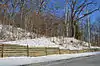 Terra Vista Archeological District |
May 23, 1978 (#78000378) |
On the edge of a bluff above the Cuyahoga River, north of its confluence with Tinkers Creek[9] 41°22′06″N 81°36′37″W / 41.3683°N 81.6103°W |
Valley View | |
| 54 | Daniel Tilden House | 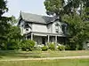 Daniel Tilden House |
June 20, 1985 (#85001340) |
2325 Stine Rd., west of Peninsula 41°14′48″N 81°35′17″W / 41.246667°N 81.588056°W |
Boston Township | |
| 55 | Tinkers Creek Aqueduct | 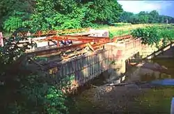 Tinkers Creek Aqueduct |
December 11, 1979 (#79000296) |
Tinkers Creek 41°21′53″N 81°36′33″W / 41.364722°N 81.609167°W |
Valley View | |
| 56 | Abraham Ulyatt House | 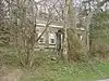 Abraham Ulyatt House |
February 27, 1979 (#79000297) |
6579 Canal Rd. 41°23′10″N 81°37′11″W / 41.386111°N 81.619722°W |
Valley View | |
| 57 | Valley Railway Historic District |  Valley Railway Historic District |
May 17, 1985 (#85001123) |
Cuyahoga Valley between Rockside Rd. at the Cuyahoga Valley National Park and Howard St. at Little Cuyahoga Valley 41°13′38″N 81°34′13″W / 41.227222°N 81.570278°W |
Brecksville and Independence | |
| 58 | Richard Vaughn Farm | 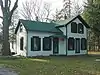 Richard Vaughn Farm |
March 12, 1993 (#93000081) |
9570 Riverview Rd. 41°18′03″N 81°34′58″W / 41.300833°N 81.582778°W |
Brecksville | |
| 59 | Wallace Farm | 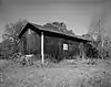 Wallace Farm |
June 27, 1985 (#85001387) |
8230 Brandywine Rd. 41°16′40″N 81°32′26″W / 41.277778°N 81.540556°W |
Northfield Center Township | |
| 60 | Allen Welton House | 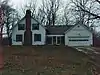 Allen Welton House |
May 7, 1979 (#79000314) |
Southwest of Peninsula at 2485 Major Rd. 41°14′00″N 81°35′01″W / 41.233333°N 81.583611°W |
Boston Township | |
| 61 | Wilson Feed Mill | 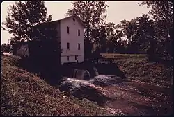 Wilson Feed Mill |
December 17, 1979 (#79000298) |
7604 Canal Rd. 41°21′22″N 81°35′48″W / 41.356111°N 81.596667°W |
Valley View |
See also
Wikimedia Commons has media related to National Register of Historic Places in Cuyahoga Valley National Park.
References
- ↑ The latitude and longitude information provided in this table was derived originally from the National Register Information System, which has been found to be fairly accurate for about 99% of listings. Some locations in this table may have been corrected to current GPS standards.
- ↑ National Park Service, United States Department of the Interior, "National Register of Historic Places: Weekly List Actions", retrieved January 12, 2024.
- ↑ Numbers represent an alphabetical ordering by significant words. Various colorings, defined here, differentiate National Historic Landmarks and historic districts from other NRHP buildings, structures, sites or objects.
- ↑ The eight-digit number below each date is the number assigned to each location in the National Register Information System database, which can be viewed by clicking the number.
- ↑ Perrin, William Henry, ed. History of Summit County, with an Outline Sketch of Ohio. Chicago: Baskin and Battey, 1881, 213.
- ↑ Bush, David R. National Register of Historic Places Inventory/Nomination: Barker Village Site. National Park Service, 1975-11-12, 2.
- ↑ Brose, David S. "The Everett Knoll: A Late Hopewellian Site in Northeastern Ohio", Ohio Journal of Science 74.1 (1974): 36-46: 38-39.
- ↑ Location derived from Brose, David S. The South Park Village Site and the Late Prehistoric Whittlesey Tradition of Northeastern Ohio. "Monographs in World Archaeology" 20. Madison: Prehistory, 1994, 18-19. The NRIS lists the site as "Address Restricted"
- ↑ Location derived from this Archived 2012-06-01 at the Wayback Machine National Park Service webpage; the NRIS lists the site as "Address Restricted"
- Miller, Carol Poh. National Register of Historic Places Inventory - Nomination Form: Ohio and Erie Canal. National Park Service November 20, 1978 https://npgallery.nps.gov/NRHP/GetAsset/NRHP/64000640_text
- National Register of Historic Places Multiple Property Documentation Form Form: Agricultural Resources of the Cuyahoga Valley. National Park Service November 20, 1978 https://npgallery.nps.gov/NRHP/GetAsset/NRHP/64500474_text
- Winstel, Jeff; Mulhauser, Kurt. National Register of Historic Places Multiple Property Documentation Form: Recreation and Conservation Resources of Cuyahoga Valley 1870-1945. National Park Service October 3, 1994 https://npgallery.nps.gov/NRHP/GetAsset/NRHP/64500486_text
This article is issued from Wikipedia. The text is licensed under Creative Commons - Attribution - Sharealike. Additional terms may apply for the media files.