Bleiswijk | |
|---|---|
Village | |
 Nederlands Hervormde Kerk | |
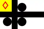 Flag 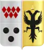 Seal | |
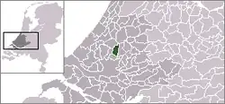 Location in South Holland | |
 Bleiswijk Location within the Netherlands | |
| Coordinates: 52°01′N 4°32′E / 52.01°N 4.54°E | |
| Country | |
| Province | |
| Municipality | |
| Area | |
| • Total | 21.96 km2 (8.48 sq mi) |
| • Land | 21.13 km2 (8.16 sq mi) |
| • Water | 0.84 km2 (0.32 sq mi) |
| Population (January 2020) | |
| • Total | 10,895 |
| • Density | 500/km2 (1,300/sq mi) |
| Time zone | UTC+1 (CET) |
| • Summer (DST) | UTC+2 (CEST) |
| Postal code | 2665 |
| Area code | 010 |
| Major roads | N209 |
Bleiswijk (Dutch: [ˈblɛisʋɛik] ⓘ) is a town and former municipality in the western Netherlands, in the province of South Holland.
Demographics
The municipality had a population of 10,222 in 2006, and covered an area of 21.96 km² (8.48 mile²) of which 0.83 km² (0.32 mile²) is water. On 1 January 2007, the town was merged with neighbouring towns Bergschenhoek and Berkel en Rodenrijs to form the new municipality Lansingerland.
According to the January 2020 census, its population was 10,895.[1]
References
- ↑ "Kerncijfers wijken en buurten 2020" (in Dutch). CBS. Retrieved November 13, 2020.
External links
Wikimedia Commons has media related to Bleiswijk.
This article is issued from Wikipedia. The text is licensed under Creative Commons - Attribution - Sharealike. Additional terms may apply for the media files.