| Bienne–Evilard Funicular | |
|---|---|
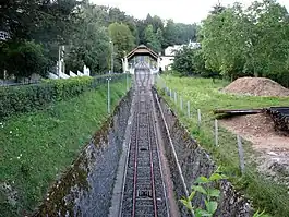
 The central station of the line (2009) | |
| Overview | |
| Other name(s) | Leubringenbahn; Funiculaire Bienne–Evilard; Drahtseilbahn Biel-Leubringen; Seilbahn Biel-Leubringen |
| Status | In operation |
| Owner | Verkehrsbetriebe Biel/Transports publics biennois (since 2014); Drahtseilbahn Biel-Leubringen (1896-1964, name change), Seilbahn Biel-Leubringen (1964-2000), FUNIC AG (2000-2013) |
| Locale | Biel/Bienne, Switzerland |
| Termini |
|
| Stations | 3 (including "Biel/Bienne Beaumont") |
| Service | |
| Type | Funicular |
| Operator(s) | Verkehrsbetriebe Biel/Transports publics biennois (short: VB/TPB) |
| Rolling stock | 2 |
| History | |
| Opened | 21 January 1898 |
| Intermediate station | 1905 |
| Technical | |
| Line length | 920 m (3,020 ft) |
| Track length | 933 m (3,061 ft) |
| Number of tracks | 1 with passing loop |
| Track gauge | 1,000 mm (3 ft 3+3⁄8 in) |
| Electrification | from opening |
| Highest elevation | 694 m (2,277 ft) |
| Maximum incline | 35.5% |

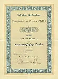
Share of the Bienne–Evilard Funicular, issued 30. December 1895
The Bienne–Evilard Funicular (German:Leubringenbahn; French:Funiculaire Bienne–Evilard) is a funicular railway in the bilingual city of Biel/Bienne in the Swiss canton of Bern. The funicular links Biel/Bienne with Leubringen/Evilard in the Jura mountains above the town.[1]
The line is operated by Verkehrsbetriebe Biel/Transports publics biennois (short: VB/TPB) since 2014.
Operation
The line has the following parameters:[1][2]
| Feature | Value |
|---|---|
| Number of cars | 2 |
| Number of stops | 3 (at terminals and passing loop) |
| Maximum steepness | (?) |
| Configuration | Single track with passing loop |
| Track length | 933 metres (3,061 ft) |
| Track gauge | 1,000 millimetres (39 in) |
| Rise | 242 metres (794 ft) |
| Travel time | 6 minutes |
See also
References
- 1 2 "BM - Bienne - Evilard (Biel - Leubringen)". Funimag. Retrieved 12 October 2011.
- ↑ Réseau ferré suisse, Secrétariat général CFF, Berne 1997, rééd. AS Verlag, ISBN 978-3-909111-74-9
External links
 Media related to Biel/Bienne–Leubringen/Evilard funicular at Wikimedia Commons
- Official web site of the FUNIC company (in German and French)
47°08′46″N 07°14′32″E / 47.14611°N 7.24222°E
This article is issued from Wikipedia. The text is licensed under Creative Commons - Attribution - Sharealike. Additional terms may apply for the media files.