Torkaman County
Persian: شهرستان ترکمن | |
|---|---|
County | |
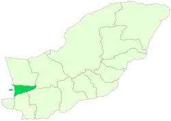 Location of Torkaman County in Golestan province | |
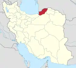 Location of Golestan province in Iran | |
| Coordinates: 36°55′N 54°10′E / 36.917°N 54.167°E[1] | |
| Country | |
| Province | Golestan |
| Capital | Bandar Torkaman |
| Districts | Central, Si Joval |
| Population (2016)[2] | |
| • Total | 79,978 |
| Time zone | UTC+3:30 (IRST) |
| Torkaman County at GEOnet Names Server | |
Torkaman County (Persian: شهرستان ترکمن), formerly Bandar Torkaman County (شهرستان بندر ترکمن), is in Golestan province, Iran. Its capital is the city of Bandar Torkaman.
At the 2006 census, the county's population was 122,218 in 25,295 households.[3] The following census in 2011 counted 72,803 people in 17,772 households,[4] by which time Gomishan District had been separated from the county in the establishment of Gomishan County,[5] Faraghi Rural District established in the Central District, and Si Joval District established. At the 2016 census, the county's population was 79,978 in 21,315 households.[2]
Administrative divisions
The population history and structural changes of Torkaman County's administrative divisions over three consecutive censuses are shown in the following table. The latest census shows two districts, four rural districts, and one city.[2]
After the 2016 census, the village of Si Joval was elevated to the status of a city.[6]
| Administrative Divisions | 2006[3] | 2011[4] | 2016[2] |
|---|---|---|---|
| Central District | 63,493 | 60,370 | 66,520 |
| Faraghi RD | 5,238 | 5,656 | |
| Jafarbay-ye Jonubi RD | 18,448 | 6,396 | 6,894 |
| Bandar Torkaman (city) | 45,045 | 48,736 | 53,970 |
| Gomishan District1 | 58,725 | ||
| Jafarbay-ye Gharbi RD | 13,650 | ||
| Jafarbay-ye Sharqi RD | 15,891 | ||
| Gomishan (city) | 15,639 | ||
| Siminshahr (city) | 13,545 | ||
| Si Joval District | 12,433 | 13,458 | |
| Qarah Su-ye Gharbi RD | 7,266 | 7,816 | |
| Qarah Su-ye Sharqi RD | 5,167 | 5,642 | |
| Si Joval (city)2 | |||
| Total | 122,218 | 72,803 | 79,978 |
| RD: Rural District 1Became a part of Gomishan County[5] 2Became a city after the 2016 census[6] | |||
References
- ↑ OpenStreetMap contributors (15 October 2023). "Torkaman County" (Map). OpenStreetMap. Retrieved 15 October 2023.
- 1 2 3 4 "Census of the Islamic Republic of Iran, 1395 (2016)". AMAR (in Persian). The Statistical Center of Iran. p. 27. Archived from the original (Excel) on 29 March 2019. Retrieved 19 December 2022.
- 1 2 "Census of the Islamic Republic of Iran, 1385 (2006)". AMAR (in Persian). The Statistical Center of Iran. p. 27. Archived from the original (Excel) on 20 September 2011. Retrieved 25 September 2022.
- 1 2 "Census of the Islamic Republic of Iran, 1390 (2011)" (Excel). Iran Data Portal (in Persian). The Statistical Center of Iran. p. 27. Retrieved 19 December 2022.
- 1 2 Mahmudzadeh, Yahya. "Based on the agreement of the government, changes have been made in the divisions of the cities, districts and villages of Golestan province". Magiran (in Persian). Ministry of Interior, Cabinet of Ministers. Archived from the original on 17 November 2023. Retrieved 17 November 2023.
- 1 2 "Si Joval became the 34th city of Golestan". Tasnim News (in Persian). 15 June 2020. Archived from the original on 15 October 2023. Retrieved 15 October 2023.
Golestan Province, Iran | ||
|---|---|---|
| Capital |  | |
| Counties and cities | ||
| Sights |
| |
| populated places | ||
| Capital | |||||||||
|---|---|---|---|---|---|---|---|---|---|
| Districts |
| ||||||||