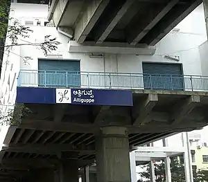
Attiguppe is an elevated metro station on the East-West corridor of the Purple Line of Namma Metro serving Attiguppe in Bangalore, India. It was opened to the public on 16 November 2015.[1][2]
Station layout
Attiguppe track layout | ||||||||||||||||||||||||||||||||||||||||||
|---|---|---|---|---|---|---|---|---|---|---|---|---|---|---|---|---|---|---|---|---|---|---|---|---|---|---|---|---|---|---|---|---|---|---|---|---|---|---|---|---|---|---|
| ||||||||||||||||||||||||||||||||||||||||||
Station with two tracks and two side platforms | ||||||||||||||||||||||||||||||||||||||||||
| G | Street level | Exit/Entrance |
| L1 | Mezzanine | Fare control, station agent, Metro Card vending machines, crossover |
| L2 | Side platform | Doors will open on the left | |
| Platform 1 Eastbound |
Towards → Whitefield (Kadugodi) next station is Vijayanagar | |
| Platform 2 Westbound |
Towards ← Challaghatta next station is Deepanjali Nagar | |
| Side platform | Doors will open on the left | ||
| L2 | ||
Entry/Exits
There are 3 Entry/Exit points – A, B and C. Commuters can use either of the points for their travel.
See also
References
- ↑ "Bengaluru Metro zooms into the west today, Magadi Road-Mysuru Road line opens". The Times of India. Retrieved 12 July 2017.
- ↑ Maya Sharma (16 November 2015). "Bengaluru Starts Metro Services Between Magadi Road, Mysuru Road". NDTV.com. Retrieved 12 July 2017.
External links
Wikimedia Commons has media related to Namma Metro.
Wikivoyage has a travel guide for Bangalore.
- Bangalore Metro Rail Corporation Ltd. (Official site)
- UrbanRail.Net – descriptions of all metro systems in the world, each with a schematic map showing all stations.
| ||
Depot(s) |
| |
See also | ||
This article is issued from Wikipedia. The text is licensed under Creative Commons - Attribution - Sharealike. Additional terms may apply for the media files.