| Ahr | |
|---|---|
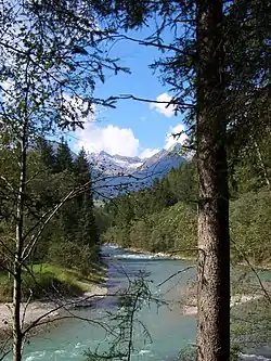 Ahr between Luttach and Sand in Taufers | |
| Location | |
| Country | Italy |
| Physical characteristics | |
| Source | |
| • location | Below the Birnlücke pass, South Tyrol, Italy |
| • coordinates | 47°4′36″N 12°12′29″E / 47.07667°N 12.20806°E |
| Mouth | Rienz |
• location | near Bruneck, South Tyrol, Italy |
• coordinates | 46°47′36″N 11°55′22″E / 46.79333°N 11.92278°E |
• elevation | 815 m (2,674 ft) |
| Length | 50.3 km (31.3 mi) |
| Basin size | 629 km2 (243 sq mi) |
| Basin features | |
| Progression | Rienz→ Eisack→ Adige→ Adriatic Sea |
| Tributaries | |
| • left | Reinbach |
The Ahr (Italian: Aurino [auˈriːno]) is a river in South Tyrol, Italy, which flows through the Tauferer Ahrntal.
References
External links
![]() Media related to Ahr at Wikimedia Commons
Media related to Ahr at Wikimedia Commons
This article is issued from Wikipedia. The text is licensed under Creative Commons - Attribution - Sharealike. Additional terms may apply for the media files.